SV-MAP-270 Navigation Mapping Software
SkyView Classic Pilot’s User Guide – Revision Z 7-14
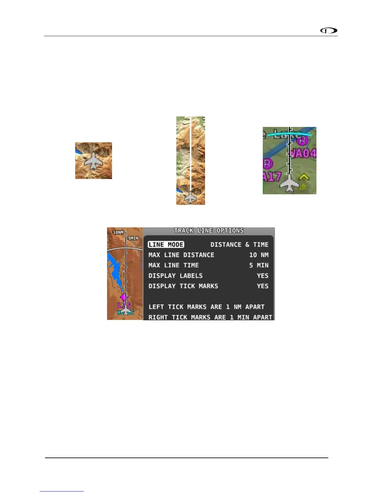
The Altitude Intercept Arc is also drawn on the ground track line (on Terrain, Enroute Charts,
and Procedure Charts). Based on the aircraft’s current vertical speed and ground speed, the
Altitude Intercept Arc shows the position over the ground the aircraft will be when it intercepts
the altitude bug. It will not show if the vertical speed is not in agreement with the altitude bug,
for example if the aircraft is descending but the bug is set above the present altitude. Also, if
you’re within 100 ft of the altitude bug or if the arc is close enough to touch the aircraft icon, it
is not displayed.