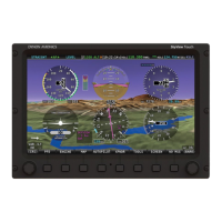
SV-MAP-270 Navigation Mapping Software
SkyView Classic Pilot’s User Guide – Revision Z 7-85
o Expired (red) – Data is at least 75 minutes old.
METAR/TAF/ Winds Information
Textual METARs, TAFs and Winds Aloft can be viewed for individual airports on their INFO
pages. Additionally, a summary of the nearest METAR weather reports for airports that report
METAR information can be found in the NRST list.
Nearest Weather
The MAIN MENU > MAP > NRST window will contain a WX (weather) tab whenever weather
information is available to SkyView:
Figure 170 - Nearest WX
The flight category below the airport identifier indicates the weather conditions at the airport.
Possible flight categories are: