SV-MAP-270 Navigation Mapping Software
SkyView Classic Pilot’s User Guide – Revision Z 7-39
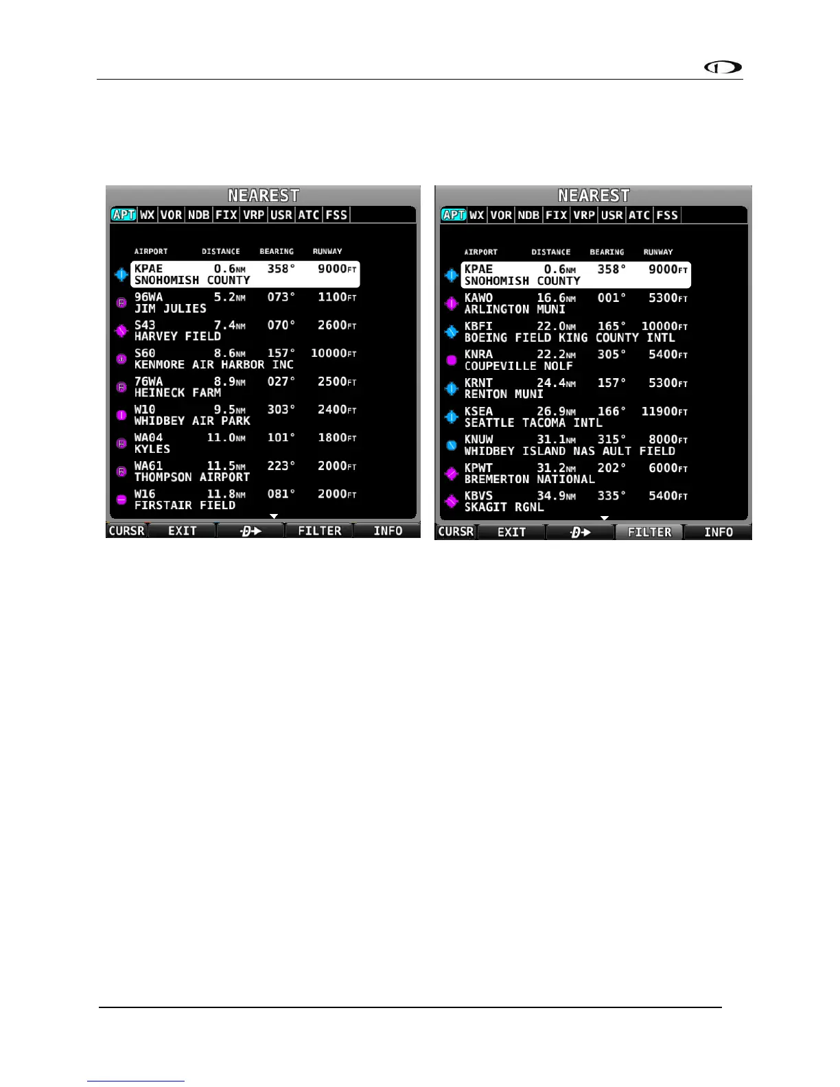
Nearest Airports, Navaids, and User Waypoints
To quickly bring up a list of the nearest airports, navaids, and user waypoints press MAP >
NRST. A window similar to the one seen in the following figures will be displayed.
Each tab in the bar of tabs at the top of the Nearest window contains a list of aviation features,
they include:
• APT – Airport
• WX – Weather (when a weather device is connected)
• VOR
• NDB
• FIX – Fixes
• VRP – Visual Reporting Points
• USR – User Waypoints
• ATC – Nearest non-airport specific ATC-frequencies, such as centers. Available with
FAA aviation data only.
• FSS – Nearest FAA Flight Service Station frequencies. Available with FAA aviation
data only.
Map Items which are set to Off in the MAP ITEMS menu, such as private airports or
seaplane bases, will not appear in the nearest list at all.