SV-MAP-270 Navigation Mapping Software
SkyView Classic Pilot’s User Guide – Revision Z 7-83
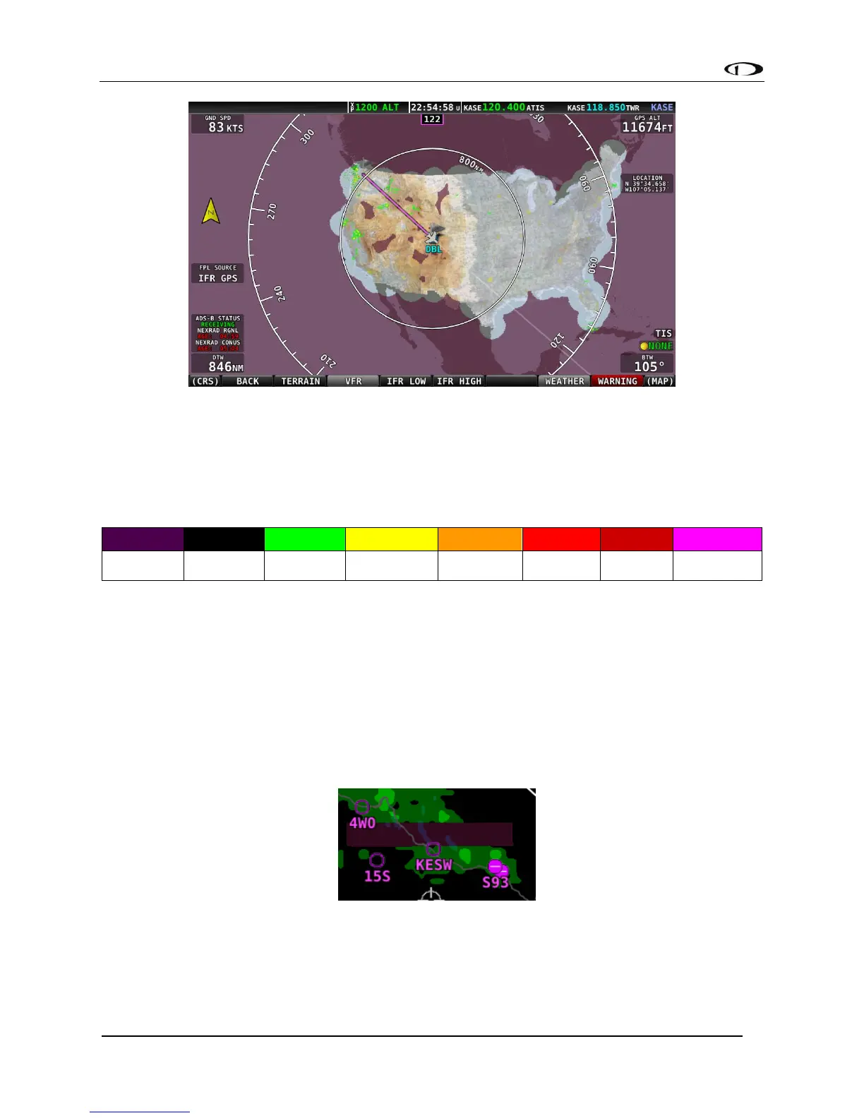
Figure 163 - Map Page: VFR and WX View
NEXRAD Legend
NEXRAD imagery is color-coded to indicate density of precipitation:
Table 7 - NEXRAD Precipitation Legend
NEXRAD Data Coverage
In some circumstances, geographic areas may not have NEXRAD imagery available. This may be
the case if:
• Data is not available for the area because there is no NEXRAD coverage in the locale. This
can be observed in the areas surrounding the US in Figure 162 above.
• Data blocks not received for an area due to radio signal obscuration, interference, or other
radio phenomena:
Figure 164 - Missing NEXAD Data Blocks
• Data has not yet been received for an area for which there is available coverage, due to the
time it takes for the ADS-B system to transmit information. For example, the following
figure depicts what the continental US would look like when higher resolution regional