Do you have a question about the Eclipse AVN6620 and is the answer not in the manual?
Sign indicating incorrect handling may result in death or serious personal injury.
Sign indicating incorrect handling may result in personal injury or property damage.
Sign indicating helpful information to remember and know.
Explains manual structure, item/section titles, and notes.
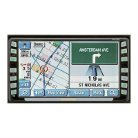
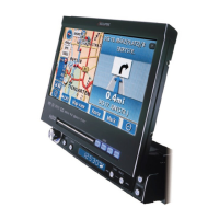
Overviews the product's capabilities and functionalities.
Details the GPS system and its navigation capabilities.
Explains the Global Positioning System technology used.
Explains main menus and list screen navigation.
Methods to navigate lists (up/down, page, POI).
How to modify screen settings and audio volume.
How display switches between day/night modes.
Adjusting screen contrast and brightness levels.
Manual switching to daytime display.
Procedure to turn off the display.
Changing map color schemes for day/night.
Options for showing or hiding the clock.
Changing distance units between miles and kilometers.
Setting the correct time zone for the region.
Adjusting the clock for Daylight Saving Time.
Adjusting audio volume levels.
Automatic volume adjustment at high speeds.
Various ways to view and interact with the map.
How the current vehicle location is shown on the map.
How to pan the map view using touch.
Toggle street name visibility during map scrolling.
How to show or hide on-screen controls.
Customizing which screen controls are visible.
Adjusting map zoom levels.
Selecting specific zoom levels.
Viewing detailed city map views.
Activating the city map view.
Exiting the city map view.
Showing building information on the map.
Enabling or disabling building outlines.
Changing map view between North-up and Heading-up.
Dividing the screen into two map views.
Controlling the secondary map view.
Displaying Points of Interest near the current location.
Returning to a single map view.
Lists available Points of Interest categories.
Quick access to POI display while driving.
Removing a POI from the map display.
Showing several POI types simultaneously.
Finding POIs near a specific point.
Listing POIs that are on the current route.
Viewing details about a selected POI.
Customizing POI categories for vicinity searches.
Process for setting destinations and finding routes.
Adjusting route search parameters for route segments.
Rearranging the sequence of multiple destinations.
Removing destinations from a route.
Marking a road as a transit point.
Removing a previously indicated transit road.
How to temporarily stop and resume navigation.
Explains how the device guides the user during travel.
Displays information for upcoming intersections.
Enables automatic display of intersection views.
Turns off automatic intersection display.
Guidance specific to ferry routes.
Shows estimated time to destination.
Adjusts speed settings for time calculations.
Guidance for highway interchanges and junctions.
Disables highway junction displays.
Navigates between highway junction views.
Provides spoken directions and announcements.
Configures automatic voice announcements.
Operations during active route guidance.
Maintaining guidance while using other functions.
Showing the full route again.
Toggles between time and distance to destination.
Moving the map along the route.
Performing a new route search.
Automatic route recalculation when deviating.
Defines point registration and its purpose.
Features for memory points with audio alerts.
Registering and using the home location.
Registering and using special memory points.
Registering detour areas.
Steps for managing home and memory points.
Modifying the registered home location.
Removing the registered home location.
Saving custom locations on the map.
Simple method for registering points.
Saving locations that are not nearby.
Adjusting the location of a saved memory point.
Modifying the icon used for a memory point.
Adding phone contact info to a memory point.
Assigning a name to a memory point.
Showing the name of a saved memory point on the map.
Removing a saved memory point.
Steps to save special memory points.
Modifying details of a special memory point.
Removing a special memory point.
Saving points to define detour areas.
Modifying saved detour area settings.
Removing a detour area from memory.
Managing past destinations from the archive.
Removing past destinations from the archive.
Overview of the RTTI feature.
Ways to view traffic information on map or text.
Enabling traffic information display.
Showing traffic flow with color-coded arrows.
Showing traffic flow with color-coded arrows.
Accessing traffic details via text.
Using traffic data to find uncongested routes.
Enabling the feature to avoid traffic jams.
Using traffic info to find uncongested routes.
Accessing system info, settings, and optional features.
Displays vehicle speed, GPS status, and brake status.
How to display the camera feed.
How to display the camera feed.
Manually activating the rear camera view.
Automatic camera activation when in reverse.
Configures auto display of camera feed.
Steps to manually adjust the vehicle's current position.
Steps to manually adjust the vehicle's current position.
Adjusting the directional indicator.
Steps to recalibrate distance measurement.
Shows information about the map data version.
Shows information about the map data version.
Explains factors affecting GPS positioning precision.
Explains factors affecting GPS positioning precision.
Factors affecting GPS signal strength.
Reasons for inaccuracies in current location display.
How tire changes affect distance calculation.
How map matching corrects position data.
Examples of displayed location vs. actual path.
Explains potential discrepancies in map data.
Troubleshooting common system messages.
Troubleshooting common system messages.
Troubleshooting common navigation issues and symptoms.
Troubleshooting common navigation issues and symptoms.
Legal information regarding software and data.
Definitions of technical terms used in the manual.
Topics related to map display and manipulation.
Various methods for finding maps.
Topics related to route planning and guidance.
Miscellaneous topics and useful functions.
Index entries starting with numbers.
Index entries starting with 'A'.
Index entries starting with 'B'.
Index entries starting with 'C'.
Index entries starting with 'D'.
Index entries starting with 'F'.
Index entries starting with 'G'.
Index entries starting with 'H'.
Index entries starting with 'I'.
Index entries starting with 'N'.
Index entries starting with 'O'.
Index entries starting with 'P'.
Index entries starting with 'R'.
Index entries starting with 'S'.
Index entries starting with 'V'.
| Resolution | 800 x 480 pixels |
|---|---|
| Touchscreen | Yes |
| Bluetooth | Yes |
| USB Port | Yes |
| Navigation | Yes |
| DVD Player | Yes |
| CD Player | Yes |
| MP3 Playback | Yes |
| WMA Playback | Yes |
| AAC Playback | Yes |
| MP4 Playback | Yes |
| AVI Playback | Yes |
| Power Output | 50W x 4 channels |
| AM/FM Tuner | Yes |
| Video Output | Yes |
| Audio Output | Yes |