shown relative to your altitude. A “+” indicates the target
is above your altitude. A “-” indicates the target is below
your altitude. For instance, if a value of +80 is shown, the
value means that the indicated traffic is 8000 feet above
your altitude. When Pressure Altitude is selected, if a
value of 121 is shown, the value means that the indicated
traffic is at 12,100 feet pressure altitude. Pressure altitude
does not showa+or-.Remember that pressure altitude
can be substantially different than the baro-corrected
altitude shown on the altimeter in your aircraft.
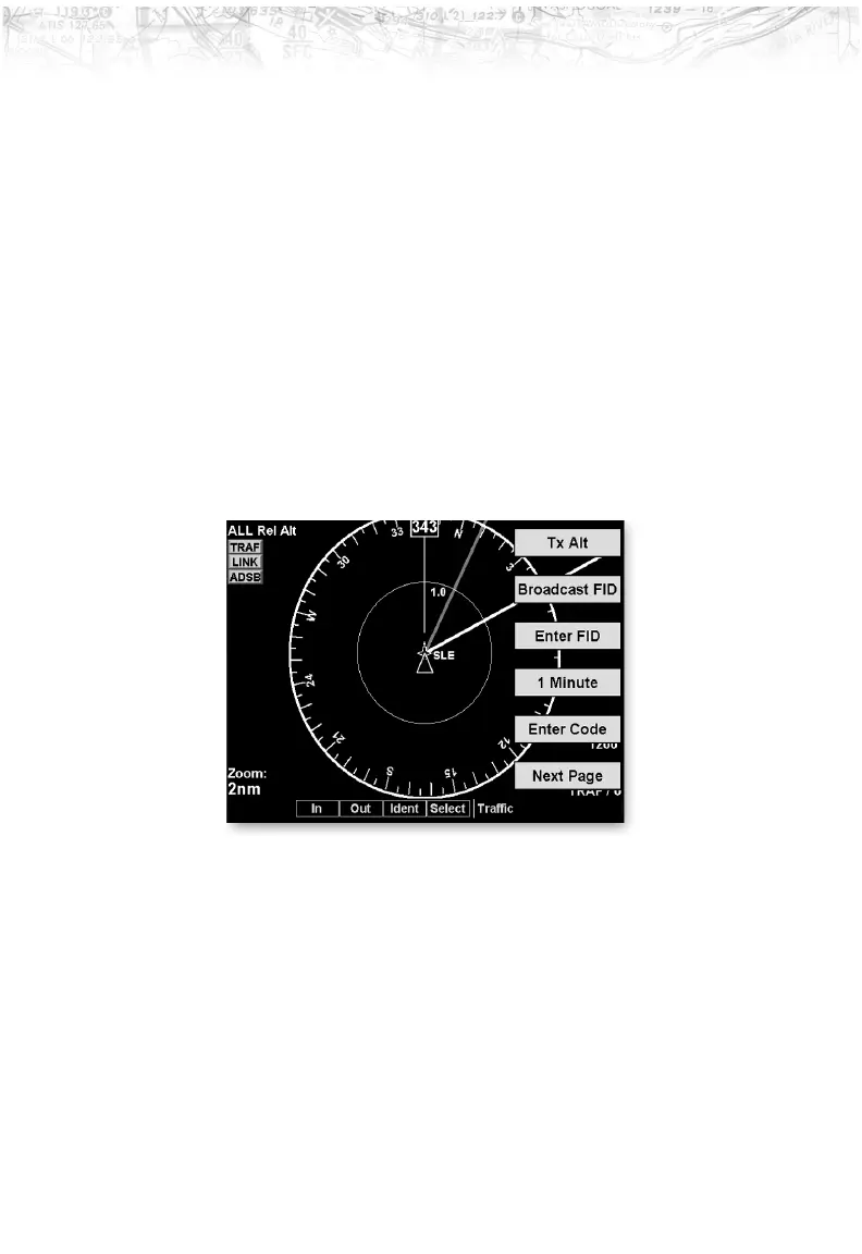
Traffic Menu Option Page 2
The second menu option page of the Traffic function lets
you select options for the choices of Transmit Altitude,
Broadcast ID, Flight ID Editing, Time Interval, and
Transponder Code.
Transmit Altitude
(ADS-B Broadcast Options - GDL 90 UAT only)
Selecting Tx Alt allows ADS-B position reports to be
transmitted with altitude information. Tx Alt Off removes
altitude information from the ADS-B position reports.
Standby suspends ADS-B position reports, but displays
other aircraft data when available. These modes are
similar to the “ALT,” “ON,” and “Standby” on a standard
transponder.
55
Detailed Operation