5. Adjust the zoom level using the IN or OUT “smart” keys.
Viewing the Chart as an Overlay
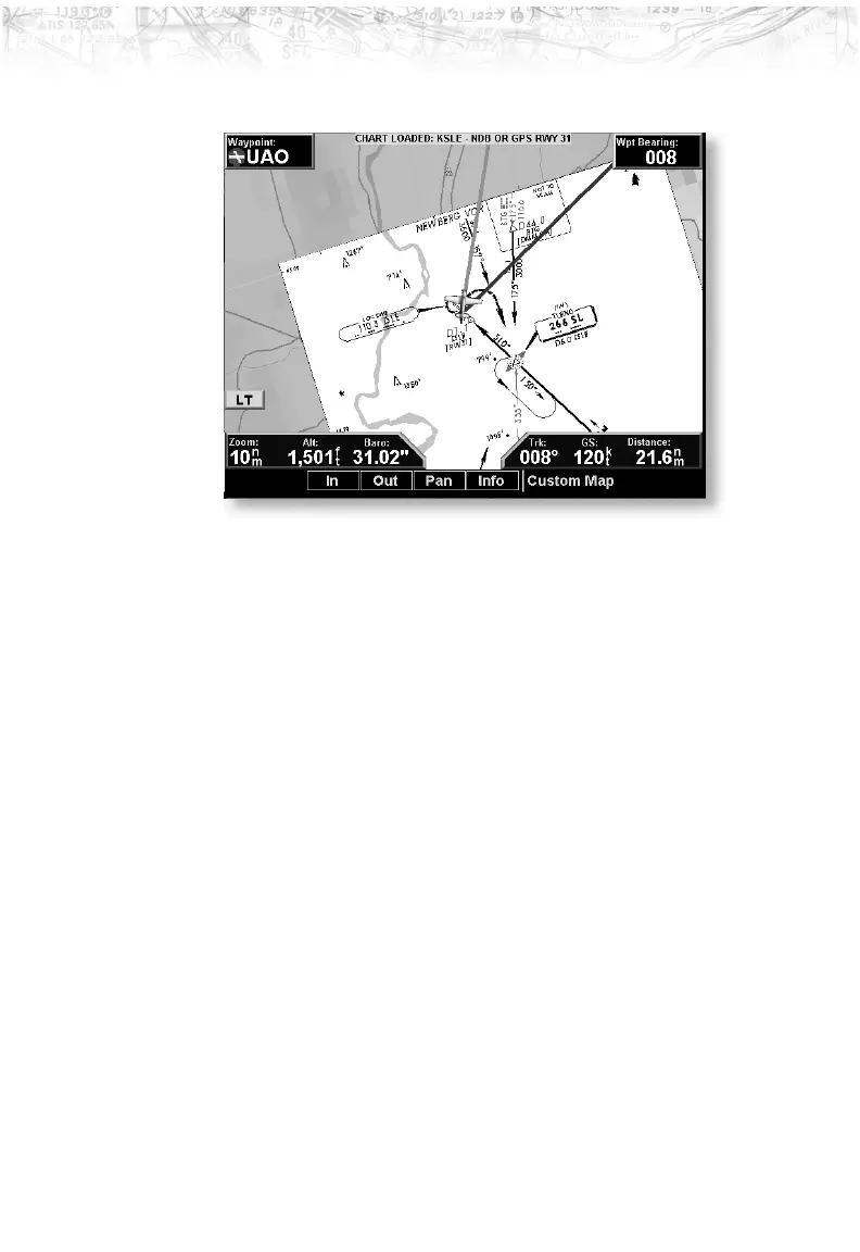
Display of Coverage Area
Once the desired approach chart has been loaded, a green
Annunciator bar with the approach name is illuminated at
the top of the Custom and IFR maps. If the aircraft is
outside the coverage area of the approach chart, a black
rectangular box will be presented that shows the coverage
of the chart itself.
Once the aircraft has entered the coverage area, the chart
contents will be displayed on the screen. Note that a
loaded approach chart is only viewable from the maps
when the aircraft is in flight, otherwise, the airport surface
chart has priority and the approach chart must be viewed
from the Chart View function.
Chart Zooming
Auto zoom mode is supported from the Custom Map and
is recommended to reduce the workload associated with
maintaining an appropriate zoom level. In auto zoom
mode (entered by zooming all the way down or all of the
way up), the zoom scale will be calculated to maintain the
current destination waypoint of your GPS receiver on the
91
Detailed Operation