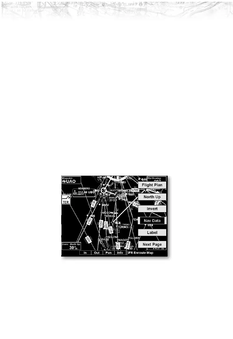
Map Orientation
This option controls the screen orientation in reference to
the aircraft symbol. You may select from North Up, Track
Up, Track Up Arc, Track Up 360, and Desired Track Up.
North Up sets magnetic north as the top of the screen.
Track Up sets the current track of the aircraft as the top
of the screen. Track Up Arc sets the current track of the
aircraft and a 120° arc at the top of the screen. Track Up
360 sets the current track of the aircraft at the top of the
screen and a 360° ring with the aircraft symbol position in
the center. Desired Track Up sets the desired track to the
next waypoint as the top of the screen. Press the
LINE
SELECT
key next to this option to scroll through the
options.
Invert
The Invert option changes the display of text and the
background color. The Invert option switches between a
white background with black text and a black background
with white text.
Nav Data
The Nav Data option allows you to control the display of
navigation data on the Map displays. Subsequent presses
of the
LINE SELECT key for this option provides choices of
no nav data, nav data in the corners (waypoint, bearing,
zoom, and distance), or full nav data. The full nav data
option includes the information in the four corners
38
Detailed Operation