EasyManua.ls Logo

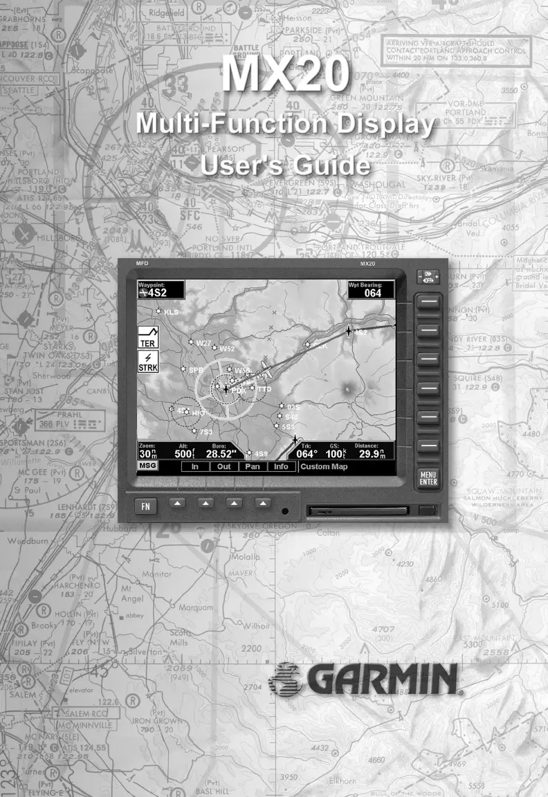
Garmin MX20 - User Manual

Garmin MX20
130 pages
Print Icon
To Next Page IconTo Next Page
Loading...

Table of Contents

Other manuals for Garmin MX20

Questions and Answers

  • B
    Brandon ObrienAug 18, 2025
    Why is my Garmin MX20 GPS unit not powering on?
    • M
      Melissa PetersonAug 18, 2025
      If your Garmin GPS unit isn't powering on, it could be due to a few reasons. First, check for proper wiring. Also, verify the display brightness setting. If the temperature is low, allow the unit to heat up for about 60 seconds. Finally, ensure the data card is fully inserted.
  • C
    Christina MillerAug 20, 2025
    What to do if my Garmin MX20 GPS shows a POS data flag?
    • J
      Joe HughesAug 20, 2025
      If your Garmin GPS shows a POS data flag, check the antenna and wiring. Also, ensure that a waypoint is selected as the current destination and a Nav flag is not shown. Verify that the serial data output is configured properly. Have your dealer/installer check for any interference sources and ensure proper MX20 setup.
  • R
    Robert RobinsonAug 22, 2025
    What does it mean if my Garmin MX20 displays an ADSB flag?
    • J
      James PhillipsAug 23, 2025
      If your Garmin GPS displays an ADSB flag, it means the GDL 90 is reporting that its internal GPS is not reporting a position or is reporting an invalid position. Ensure the GDL 90 is installed and functional, and also ensure the GDL 90 GPS antenna has a clear view of the sky to receive GPS signals.
  • M
    Melissa RossAug 26, 2025
    What does it mean if my Garmin MX20 GPS displays a TER (Terrain) flag?
    • T
      tiffanywongAug 26, 2025
      If your Garmin GPS displays a TER (Terrain) flag, ensure that the proper database is used for your location and it passed the startup test. Have your dealer/installer check for proper altitude input.
  • B
    Barbara LittleAug 27, 2025
    What to do if my Garmin MX20 GPS unit fails during the start up test?
    • D
      Derrick DavisAug 27, 2025
      If your Garmin GPS unit fails during the start up test, make sure the data card is fully inserted. If the issue persists, contact your dealer or the factory due to a potential system failure.
  • G
    Gregory MeadowsAug 30, 2025
    Why is there no traffic display on my Garmin GPS?
    • D
      David QuinnAug 30, 2025
      To see a traffic display on your Garmin GPS, you must have the ADS-B system installed. If you do have an ADS-B system, check the antennas and other components for proper operation. Have your dealer/installer check for proper MX20 setup.
  • C
    Christopher GomezSep 1, 2025
    What does the RTE (Route) flag mean on my Garmin MX20 GPS?
    • N
      nolsonSep 1, 2025
      The RTE (Route) flag on your Garmin GPS indicates that the external position source has an active route engaged.
  • M
    Melanie KirkSep 4, 2025
    What does it mean if my Garmin GPS displays an ALT (Altitude) flag?
    • S
      Shane MillerSep 4, 2025
      If your Garmin GPS displays an ALT (Altitude) flag, ensure the serial altitude encoder is powered up and working properly. Have your dealer/installer check for proper installation and setup of the encoder. If altitude data is provided by an Apollo GX product, ensure that the GPS position has been acquired and a waypoint is selected as the current destination.
  • M
    Michael WalkerSep 6, 2025
    What does the “Special Terrain” message on my Garmin GPS mean?
    • A
      Allen GibbsSep 7, 2025
      The “Special Terrain” message on your Garmin GPS is normal for the Capstone installation. Have dealer/installer check for proper MX20 setup.
  • J
    John HillSep 9, 2025
    What to do if my Garmin GPS displays a TCAD flag?
    • L
      Leslie JonesSep 9, 2025
      If your Garmin GPS displays a TCAD flag, ensure that the TCAD unit is installed and functional.

Summary

MX20 Initial Information

History of Revisions

Records changes made to the manual through its revision history.

Ordering Information

Details on how to obtain additional copies of the MX20 User's Guide.

End User License Agreement

Legal terms and conditions for using the MX20 software and operating system.

MX20 Getting Started Guide

MX20 Functions Overview

Lists and describes the major functions available on the MX20 display interface.

MX20 Controls and Operation

Explains power, brightness, and key controls for operating the MX20 unit.

MX20 Display and Annunciations

Details the display screen layout, annunciations, and data flags for system status.

Basic MX20 Operation Steps

Covers power-up, brightness, initial checks, and basic operational procedures.

MX20 Detailed Operation and Features

Custom Map Function Guide

Enables customized map display by overlaying various information for situational awareness.

Traffic Information Functions

Covers Skywatch/TCAD, ADS-B, TIS-A traffic display, symbology, and alerts.

Terrain and Obstruction Display

Details topographic features display, including sectional and terrain awareness views.

Weather and Lightning Information

Describes graphical/text weather data (FIS) and lightning strike information from WX500.

Radar System Operation

Explains interface with weather radars (ART2000/2100), including modes and display options.

System Configuration and Tests

Covers setting navigation preferences, obtaining version info, and performing diagnostic tests.

MX20 Maintenance and Troubleshooting

MX20 Display Care and Cleaning

Provides recommended methods for cleaning and maintaining the MX20 display screen.

Troubleshooting Common MX20 Issues

Lists common problems, causes, and recommended actions for resolving MX20 operational issues.

Garmin MX20 Specifications

General IconGeneral
Display TypeColor LCD
Water ResistanceIPX7
GPS Receiver12-channel
Routes50
CategoryAviation GPS
Track Log10, 000 points
Map StorageInternal
Operating Temperature-15°C to 55°C (5°F to 131°F)

Related product manuals