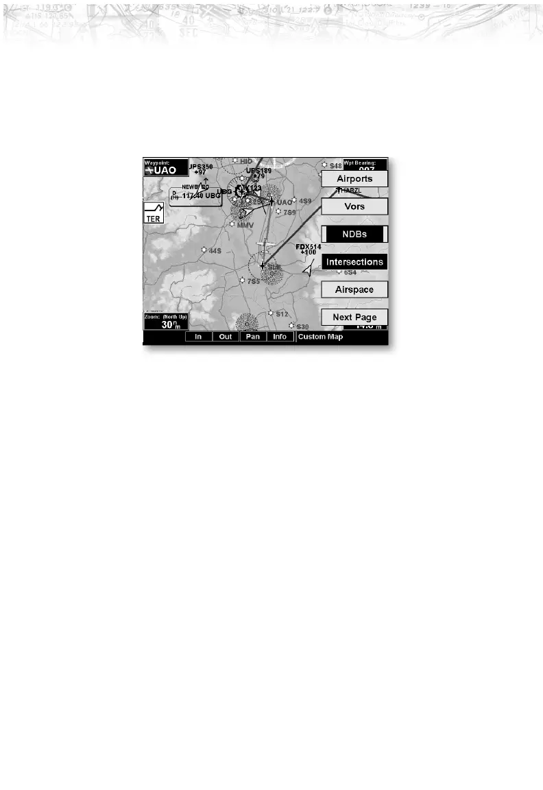
Custom Map Menu Option Page 2
The second option page of the Custom Map function lets
you select options for the choices of Airports, VORs,
NDBs, Intersections, and Airspace. The last option
selection takes you to the next page of options.
Airports
The Airports option allows you to choose the level of
airport information displayed on the Map screen. You
may select the display of airport icon and identifier, icon
only, or no information by each subsequent press of the
Airport
LINE SELECT option keys.
VORs
The VORs option allows you to choose the type of VOR
information displayed on the Map screen. You may select
the display of VOR icon and identifier, icon only, or no
information by each subsequent press of the VOR
LINE
SELECT
key.
The MX20 supports full integration with the SL30
Nav/Com. This feature allows tuned VORs along with
ILS and localizer approaches to be shown on the MX20
moving map. This high level of integration is designed to
provide additional, simple to interpret situational
awareness during high work-load phases of flight. The
graphic display of Nav/Comm information on the MX20
28
Detailed Operation