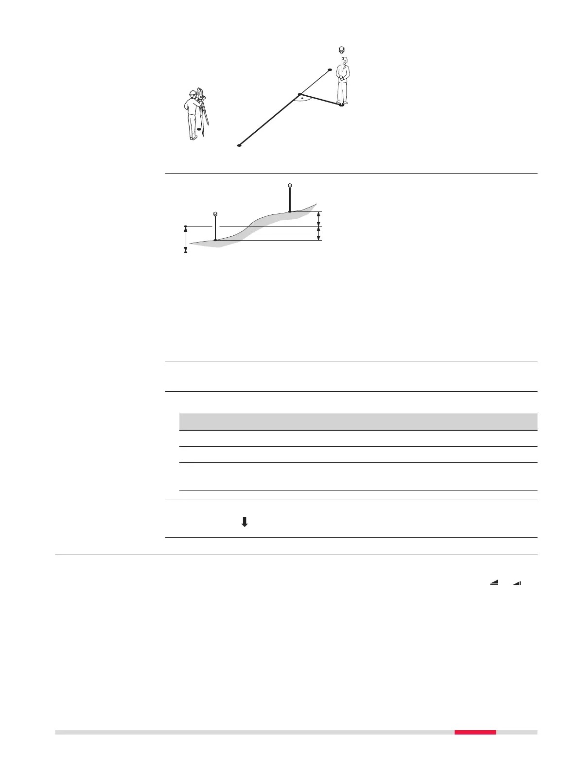
P0 Instrument station
P1 Start point
P2 End point
P3 Measured point
P4 Reference point
d1 D Offset
d2 D Line
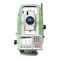
P1 Start point
P2 Target point
P3 Target point
a Reference height
d1 Height difference between start point and the reference height
d2 Height difference between P2 and the reference height
d3 Height difference between P3 and the reference height
Press Meas in the Reference Line - Info screen.
Description of fields
Field
Description
ΔL Calculated distance longitudinal to the reference line.
ΔO Calculated distance perpendicular from the reference line.
ΔH Calculated height difference relative to the defined reference
height.
•
Either, press Meas to measure and record.
•
Or, press Back to return to the Reference Line - Info screen.
7.5.5 Stakeout
The stakeout subapp calculates the difference between a measured point and
the calculated point. The orthogonal (ΔL, ΔO, ΔH) and polar (ΔHz, D , D )
differences are displayed.
Example of height dif-
ference relative to
first reference point
Access
Measure line & offset
Next step
Description
Apps 87



 To Next Page