Description of fields
Field Description
ΔHz Horizontal direction from the measured point to the stake
out point. Positive if the telescope must be turned clockwise
to the stake out point.
ΔL Longitudinal distance from the measured point to the stake
out point. Positive if stake out point is further away than the
measured point.
ΔO Perpendicular distance from the measured point to the stake
out point. Positive if stake out point is to the right of the
measured point.
D Horizontal distance from the measured point to the stake
out point. Positive if the stake out point is further away than
the measured point.
D Height difference from the measured point to the stake out
point. Positive if the stake out point is higher than the meas-
ured point.
•
Either, press Meas to measure and record.
•
Or, press Back to return to the Reference Line - Info screen.
7.5.6 Grid Stakeout
The Grid subapp calculates and displays the stake out elements for the points
on the grid, orthogonal (ΔL, ΔO, ΔH) and polar (ΔHz, D , D ). The grid is
defined without boundaries. It can be extended over the first and second base
points of the reference line.
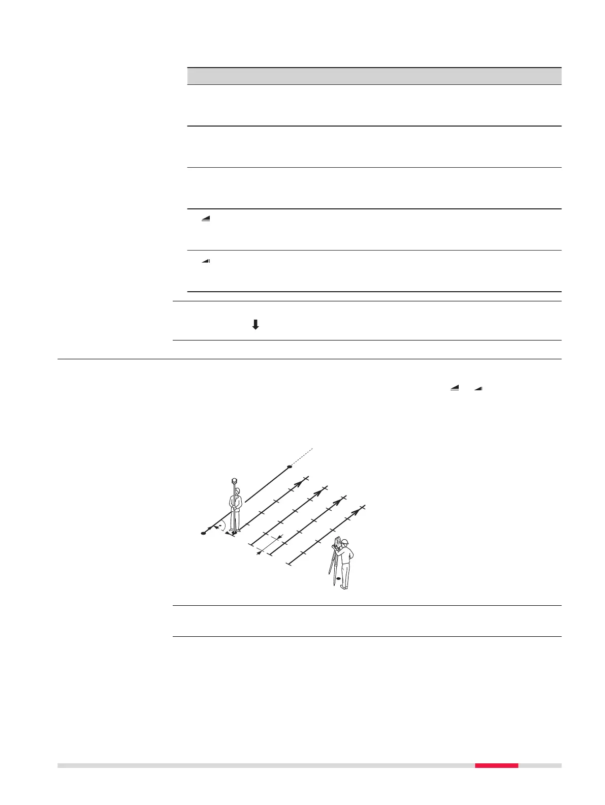
Example Grid Stakeout
a Reference line
P0 Instrument station
P1 Start point
P2 End point
d1 Start distance
d2 Increment
d3 Line offset
Press Grid from the Reference Line - Info screen.
Enter the chainage and the increment of grid points in length and cross direc-
tion of the reference line.
Next step
Description
Access
Grid definition
Apps 89



 To Next Page