86 VQT2R24 VQT2R24 87
Recording the place of recording with GPS
(continued)
Recording mode:
∗
∗
Record only (Cannot set)
[GPS AREA SELECT]
Change the recorded place name information
If positioning results and current position are different from each other, if there are
other candidate locations, you can change the information to nearby place names or
landmarks.
If [?] is displayed before the place name,
you can choose other candidate locations.
Select [GPS AREA SELECT]
(→20), from the [TRAVEL
MODE] menu
Select the place name or
landmark to be changed
From the displayed
candidates, select the
desired place name or
landmark to be recorded
Return to menu screen
■
If you do not wish to record place names and landmarks
In step above, select [DELETE ALL PACE-NAMES] and place names and landmarks
will not be recorded.
Or, in step , if you select [YES] when a message asking whether to delete place
names and landmarks lower than the selected place name, information of the place
name will not be recorded (e.g., city and town names and landmarks if specifying a
prefecture name).
• However, longitude and latitude will be recorded. If you do not wish to record them,
turn [GPS SETTING] to [OFF].
■
When GPS is enabled
In recording mode, an icon that indicates the positioning status is displayed on the LCD
monitor.
Then, if positioning is successful, the location name information is displayed.
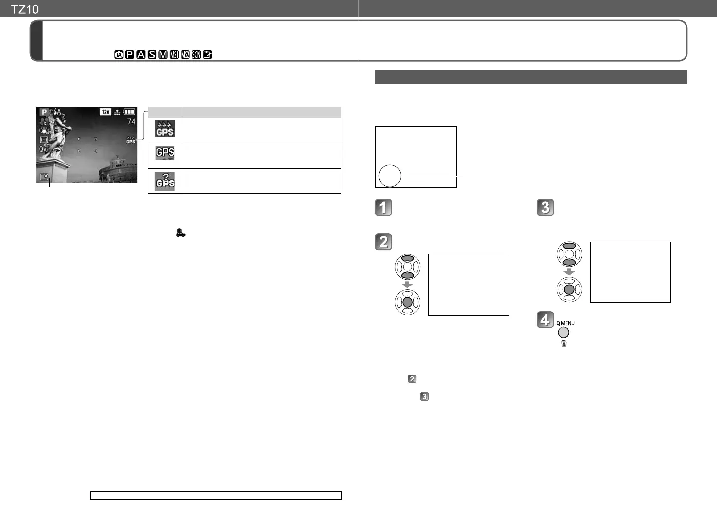
Location name information
Icon Positioning status
Positioning in progress
• Positioning may take some time. (Maximum of
5 minutes)
Positioning successful
• The location name information is updated.
• Positioning will be faster from the next time.
Positioning failed
• Cannot correctly receive the signals from the
GPS satellites.
●
When positioning is in progress or positioning has failed, the location name
information from the previous (last) positioning is recorded. However, note that in the
following cases, the location name recording is deleted, so the location name is not
recorded on the pictures.
• When [GPS SETTING] is set to [OFF] or before turning off the camera's power
• If the GPS function stopped while [GPS SETTING] is set to [ON] and the camera's power is off
(→85)
●
Because the GPS satellites are constantly moving, for positioning to be performed,
first the orbit information of the GPS satellites must be acquired, and then the
signals from the GPS satellites must be received. The current position can then be
calculated. For this reason, the first positioning after turning on the camera's power
takes longer than normal. (Except when [GPS SETTING] is set to [ON] and the GPS
did not stop while the camera's power was off.)
●
Positioning is not performed in playback mode.
■
Location name information recorded on recorded pictures
When the GPS function is enabled and positioning is successful, the current position
is stored in the camera's memory, and the location name information, latitude and
longitude are recorded on recorded still pictures, and motion pictures recorded with
[AVCHD Lite (GPS)].
●
Position information recorded on recorded pictures
• Latitude/longitude
*1
•
Country or region name/prefecture, state or province name/city or town name/landmark name
*2
*1
These are recorded as EXIF information, so in some cases may be used in compatible
applications available on the market.
*2
You can check the recording location of pictures or display them by location of recording with
this camera or the ‘PHOTOfunSTUDIO’ software on the supplied CD-ROM.
●
In some cases, the desired landmark may not be registered. Landmarks and other
location name information are current as of February 2010. (Landmark types →171)
●
In large public parks or similar locations, landmarks may not be displayed, or
incorrect landmarks may be displayed. If you cannot select the desired landmark in
[GPS AREA SELECT], perform [PLACE-NAME EDIT] after recording. (→134)
[GPS SETTING] is not available in the DMC-TZ9/DMC-TZ8.
 Loading...