______________________________________________________________________________
____________________________________________________________________________
LMM for the Kodiak 100 Page 4-75
190-02102-00 Rev.4
4.7.8 GRS 79 / GMU 44B (AHRS) Troubleshooting
4.7.8.1 AHRS Description
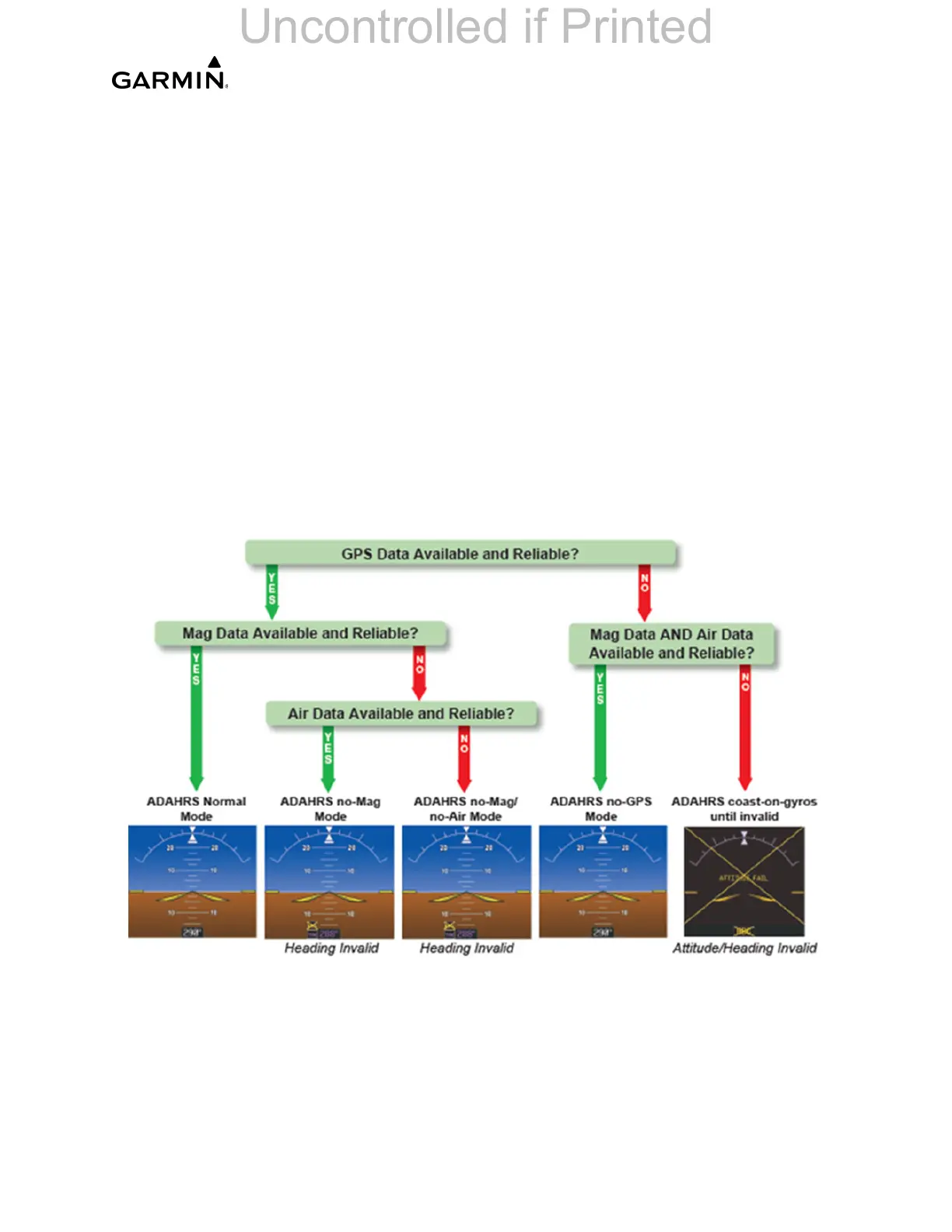
In addition to using internal sensors, the GRS 79 AHRS uses GPS information, magnetic
field data and air data to assist in attitude/heading calculations. In normal mode, the
AHRS relies upon GPS and magnetic field measurements. If either of these external
measurements is unavailable or invalid, the AHRS uses air data information to assist in
attitude determination. Four AHRS modes of operation are available and depend upon
the combination of available sensor inputs (see Figure 4-15). Loss of air data, GPS, or
magnetometer sensor inputs is communicated to the pilot by message advisory alerts.
The AHRS (GRS 79) corrects for shifts and variations in the Earth’s magnetic field by
applying the Magnetic Field Variation Database. The Magnetic Field Variation Database
is derived from the International Geomagnetic Reference Field (IGRF). The IGRF is a
mathematical model that describes the Earth’s main magnetic field and its annual rate of
change. The database is updated approximately every five years. The system will
prompt the pilot on startup when an update is available. Failure to update this database
could lead to erroneous heading information being displayed to the pilot.
Figure 4-15. AHRS Basic Operation

 Loading...


