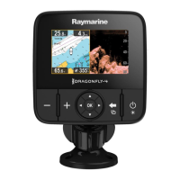
9.1Chartapplicationoverview
TheChatapplicationisavailableonproductsthat
includeaninternalGPS/GNSSreceiver.Ituses2D
perspectiveandprovidesavarietyofcartographic
informationregardingyoursurroundingsand
chartedobjects.TheChartapplicationispre-loaded
withLightHouse
™
,Navionics
®
andC-MAPby
Jeppesen
®
worldbasemaps.Compatibleelectronic
chartscanbeusedtoexpandtheinformationand
detailregardingyoursurroundingsandcharted
objects.
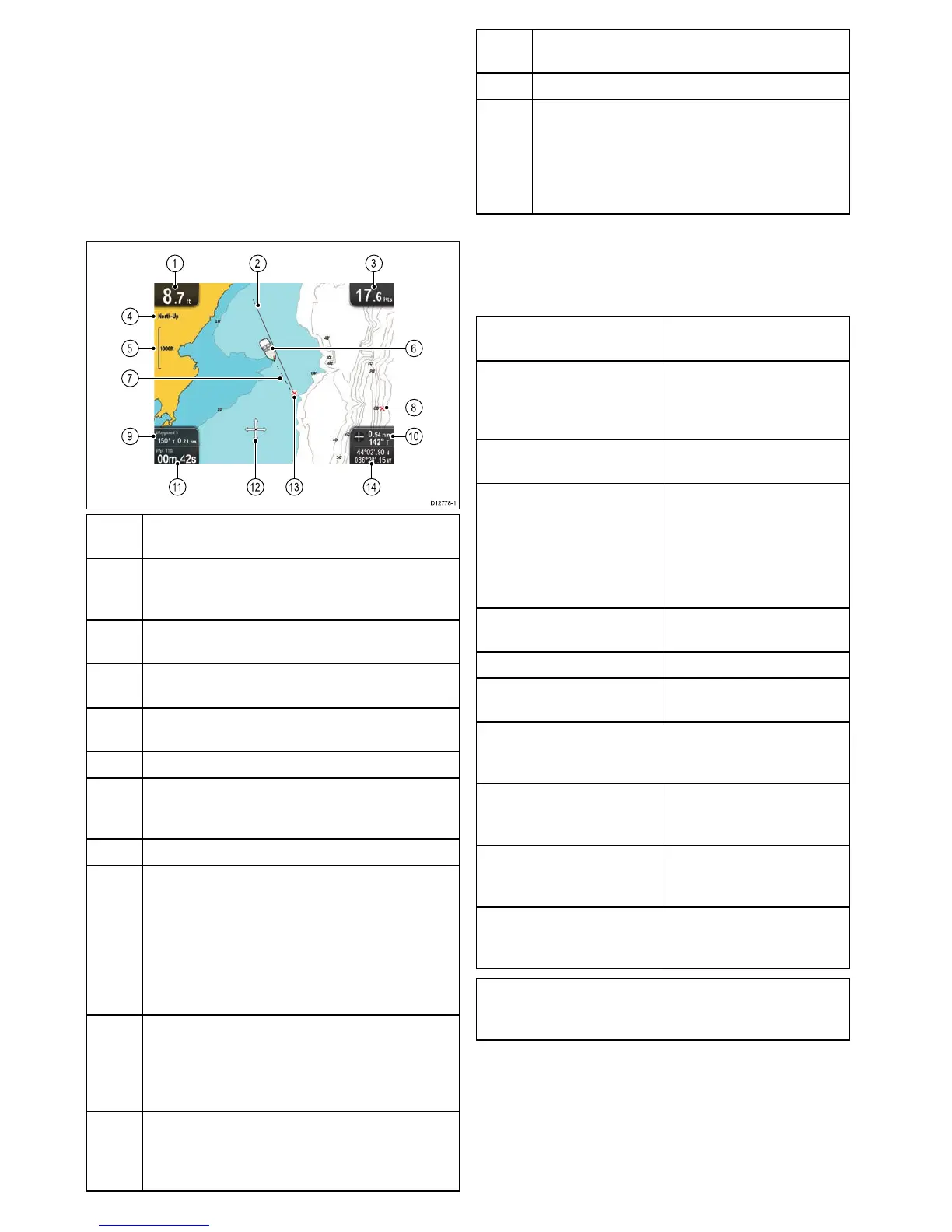
1
Depth—Currentwaterdepth(onlyavailablewith
transducerconnected).
2Navigationoriginline—Duringnavigation,shows
asolidlinefromthestartingpointtothetarget
waypoint.
3
Speed—Currentvesselspeed(showninselected
systemunits).
4
Orientation—Statestheorientationmodethatthe
chartisusing(North-up,orCourse-up).
5
Range—Chartscaleindicator(showninselected
systemunits).
6
Vesselsymbol—Showsyourcurrentposition.
7
Vesselpositionline—Duringnavigation,shows
adottedlinefromthevessel’scurrentpositionto
thetargetwaypoint.
8Waypoint—Inactive.
9Watertemperature—Whennotinactivenavigation
currentwatertemperatureisdisplayed.
Distancetocursor/waypoint—(Appliesto
Dragony–4andDragony–5)Duringactive
navigationthedistancetothetargetisdisplayed.
Bearinganddistancetocursor/waypoint
—(AppliestoDragony–7only)Duringactive
navigationthedistancetothetargetisdisplayed.
10Bearing—Inmotionmodethevessel’scurrent
COGbearingisdisplayed.
Cursorbearinganddistance—Incursormode
thebearinganddistancetothecursor’slocation,
fromyourvesselisdisplayed.
11
WaypointTTG—(AppliestoDragony–7only)
Duringactivenavigationtheestimated‘timetogo’
tothetargetcursor/waypointbasedonyourcurrent
speedisdisplayed.
12
Cursor—Usedtoselectchartobjectsandmove
aroundthechartarea.
13
Targetwaypoint—Currenttargetwaypoint.
14
Vesselcoordinates—(AppliestoDragony–7
only)Inmotionmodethecurrentvesselcoordinates
aredisplayed.
Cursorcoordinates—(AppliestoDragony–7
only)Incursormodethecoordinatesofthecursor’s
locationisdisplayed.
TheChartapplicationincludesthefollowing
featurestohelpyounavigateyourvesselsafelyand
effectively:
Features
Usingsatellite-based
navigation.
•7.4Satellite-based
navigation
Planningwithwaypointsand
tracks.
•9.4Waypointsoverview
•9.5Tracks
•
Navigatingusingwaypoints
andtracks.
•9.8Navigation
Choosingelectronic2D
cartography.
•9.10Chartselection
•9.2Electroniccharts
overview
–LightHousecharts
–Navionicscharts
Backingupandtransferring
WaypointsandTracks.
•Savinguserdataanduser
settings
DisplayingCOGvectors•9.18COGVector
Viewinginformationfor
chartedobjects.
•9.20Chartobjects
Controllingthelevelof
informationdisplayedonthe
Chartapplication
•9.11ChartDetail
AlteringtheChart
application’sorientation
tobettersuityourneeds.
•9.13Chartorientation
Changingtheboatsymbol
positionintheChart
application.
•9.15Boatposition
ChangingtheDepthatwhich
theDeepWatercontour
changescolor.
•9.19DeepWater
Note:Toobtainfullchartdetails,youmusthave
acartographychartcardfortheappropriate
geographicareainsertedintothecardreader.
70
Dragony–4/Dragony–5/Dragony–7/Wi–Fish
 Loading...