78 RC400 GPS Chartplotter
Navigation Data
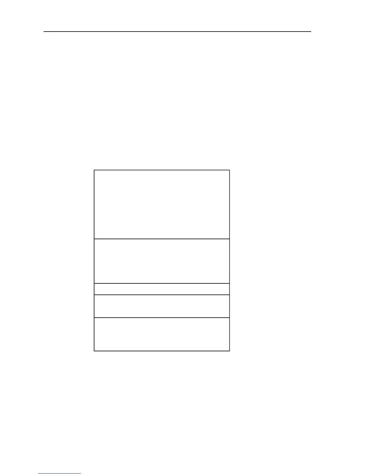
The Navigation Data display comprises text data occupying the whole
screen:
Textual data provides Position, SOG, COG, Bearing and Range to
waypoint, Time, Fix status and the XTE indicator. Any unavailable data
is replaced by dashes, one per character. When there is no GPS fix but
there is a value for the last fix, this is shown instead; POSITION is replaced
with LAST POSITION.
The (c) indicator only appears when the position has been user calibrated.
The Fix indicator shows the GPS Fix status and indicates either FIX OK,
SD FIX or NO FIX.
Figure 5-8: Navigation Data
Note: Graphical XTE indicator is as per Waypoint Data on page 76.
D6244-2
POSITION
50°46.338'N
1°10.391'W
COG 313° T
SOG 5.0 Kts
WAYPOINT "HILLHEAD"
BRG 313°T GPS FIX OK
RNG 3.74nm TIME 02:15 10/07/04
STEER STARBOARD
> l
 Loading...


