CP42/50/52 NAV menus & navigation examples Chapter 6
68
Route: RTE 3 5
BN: 16.4° TDG: 35.7nm TTG: 2h34m
S8.2
V7.4
C359
°
°°
°
B314
°
°°
°
X0.011
D17.3
0.04nm
0.02nm
0.02nm
0.04nm
0.02nm
0.02nm
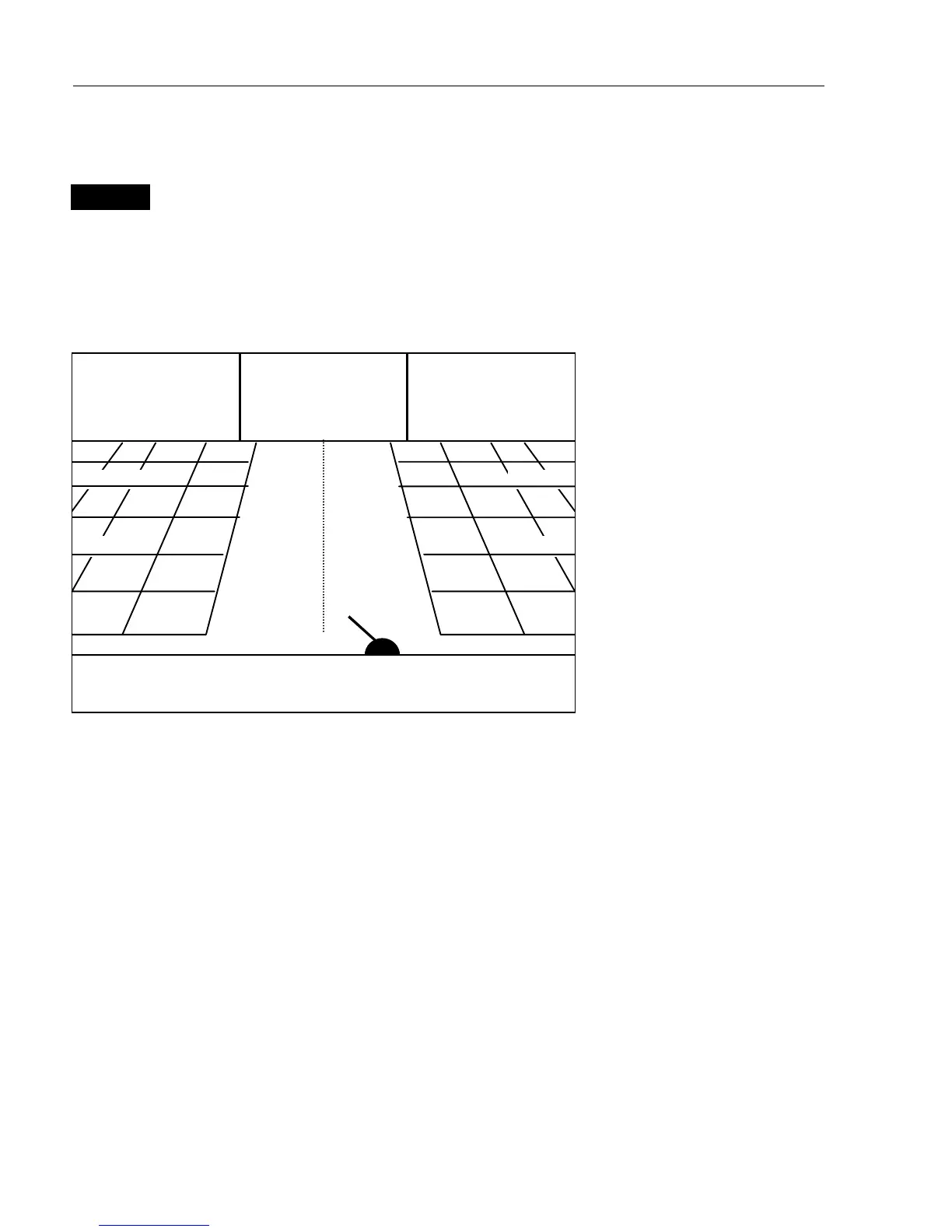
6.2.1 Highway display
NAV
Direct access to Highway display
- or gain access via
[MENU],[4],[1]
With navigation mode active, the highway display will provide a
graphical steering display:
C: Course over ground
X: XTE – Cross-track-error
S: Speed over ground
B: Bearing to approaching
point
D: Distance to approaching
point
V: Speed towards point
Route: Name of active
route
Point: No. of approaching
point
TDG: Total distance to go
BN: Bearing to next point
TTG:Timetogo(onlyfor
waypoint navigation).
n
Ship’s position and course in relation to intended track.
n
o
Intended track between two waypoints or from ship’s position when
NAV is activated.
p
XTE alarm lines – an alarm will be activated if the ship moves across
the lines (if the alarm is enabled).
Refer to section 6.1.1 for alarm setup.
n
o
p
p