NX501E/NZ501EEnglish11
2.2Mapscreen
2.2.1Navigatingonthemap
TheMapscreenisthemostfrequentlyusedscreenofClarionMobileMap.
A small live map is displayed on thes tartup screen,the Navigationmenu, as a partof the
button.
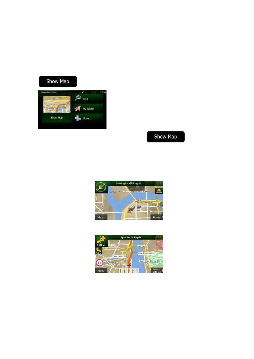
ToenlargethissmallmapandopentheMapscreen,tap .
This map shows the current position (the Vehimarker, a red arrow by default), the
recommendedroute(anorangeline),andthesurroundingmaparea.
When t here is no GPS position, the Vehimarker is transparent. It shows your last known
position.
Youseecoloureddotscirclingaroundasatellitesymbolinthetopleftcorner.Themoregreen
dotsyousee,thecloseryouaretogetthevalidGPSposition.
WhenGPSpositionisavailable,theVehimarkerisdisplayedinfullcolour,nowshowingyour
currentposition.
There are screen buttons and data fields on the screen to help you navigate. During
navigation,thescreenshowsrouteinformation.
Bydefault,onlyonedatafieldisdisplayedinthebottomrightcorner.Tapthisfieldtoseeall
routedatafields.
 Loading...