NX501E/NZ501EEnglish13
2.2.2Positionmarkers
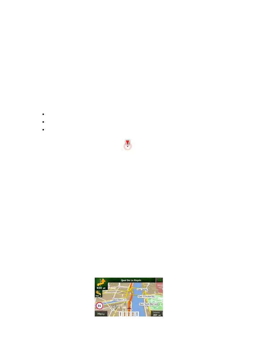
2.2.2.1VehimarkerandLock-on-Road
WhenyourGPSpositionisavailable,ClarionMobileMapmarksyourcurrentpositionwiththe
Vehimarker.Bydefault,thismarkerisaredarrow,butyoucanchangethisiconinSettings.
TheVehimarkermaynotshowyourexactGPS position andheading.If roadsarenear,itis
alignedtothenearestroadtosuppressGPSpositionerrors,andthe directionofthe iconis
alignedtothedirectionoftheroad.
2.2.2.2Selectedmaplocation(Cursor)andselectedmapobject
Youcanmarkamaplocationinthefollowingways:
Tapthemapwhennavigating,
Tapthemapwhenyouareaskedtoconfirmthedestinationattheendofasearch,or
TapthemapinFindonMap(page45)
Whenamaplocationisselected,theCursorappearsattheselectedpointonthemap. The
Cursorisdisplayedwitharadiatingreddot(
)tomakeitvisibleatallzoomlevels.
ThelocationoftheCursorcanbeusedasthedestinationoftheroute,anewalertpoint,you
can search for Places around it, or you can save this location as one of your Favourite
destinations.
Youcanalsoselectsomeoftheobjectsonthemap.IfyoutapthemapattheiconofaP lace
ofInterestoranalertpoint,theobjectwillbe s elected(youseearedcirclingborderaround
theobject),andyoucangetinformationaboutthisobjectoruseitasaroutepoint.
2.2.3Objectsonthemap
2.2.3.1Streetsandroads
Clarion Mobile Map shows thestreets in a way that is similar to how thepaper road maps
show them. Their width and colours correspond to their importance: you can easily tell a
motorwayfromasmallstreet.
2.2.3.2TurnpreviewandNextstreet
Whennavigatingaroute,thetopsectionoftheMapscreenshowsinformationaboutthenext
routeevent(manoeuvre)andthenextstreetorthenextcity/town.