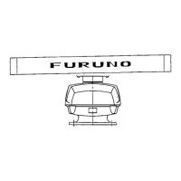
How to improve poor sensitivity on Furuno Marine Radar?
- GGabrielle ChristianSep 4, 2025
If your Furuno Marine Radar has poor sensitivity, it could be due to a 2nd trace echo or a soiled radiator. Remove the 2nd trace echo and clean the radiator.
How to improve poor sensitivity on Furuno Marine Radar?
If your Furuno Marine Radar has poor sensitivity, it could be due to a 2nd trace echo or a soiled radiator. Remove the 2nd trace echo and clean the radiator.
Why is the monitored user chart not displayed on my Furuno Marine Radar?
If a monitored user chart isn't showing on your Furuno Marine Radar, it could be because the user chart is not selected visible, or the user chart display is selected for planning mode. To solve this, open the Mariner page of the Chart Display menu and select User Chart’s parts to either Std or Oth. Unselect user chart in planning mode.
How to fix Furuno Marine Radar when the power cannot be turned on?
If your Furuno Marine Radar isn't powering on, the issue might stem from a few causes: the power connector may have loosened, the ship’s mains could be off, or a fuse might have blown. To resolve this, check the connector to ensure it's properly secured. Verify that the ship’s mains are active and providing power. Lastly, inspect the fuse and replace it if necessary.
What causes Furuno Marine Radar ARP target to not be tracked correctly?
If the ARP target on your Furuno Marine Radar is not being tracked correctly, it may be due to sea surface reflections masking the ARP target. Adjust the A/C SEA and A/C RAIN settings to suppress sea and rain clutters.
How to fix Furuno Marine Radar when range rings are not displayed?
If the range rings are not displayed on your Furuno Marine Radar, it could be because the range rings are turned off. Turn on the range rings from the Color menu.
Why is the planned route not displayed on my Furuno Marine Radar?
If the planned route is not displayed on your Furuno Marine Radar, this could be because the route is selected, or the planned route is not selected visible top on chart. Select the route as planned. Open the Route page of the Chart Display menu and select planned route parts to Std or Other.
Why is the monitored route not displayed on my Furuno Marine Radar?
If the monitored route is not displayed on your Furuno Marine Radar, it could be because the route is not selected, or the chart is not set to display on the foremost chart layer. To resolve this, select the monitor route.
What to do if Furuno Marine Radar power turned on but radar does not operate at all?
If your Furuno Marine Radar powers on but doesn't operate, the cause may be a blown fuse, incorrect mains voltage/polarity, or a faulty power supply board. Replace the blown fuse. Correct the wiring and input voltage. Replace the power supply board.
What to do if Furuno Marine Radar picture does not change even though range is changed?
If the picture on your Furuno Marine Radar isn't changing when you adjust the range, the issue might be a faulty range key or a video freeze. Try pressing the RANGE key several times. If nothing happens, turn the power off and on again.
Why Furuno Marine Radar position cannot be found?
If your Furuno Marine Radar cannot find its position, it might be because the sensors are not selected in the SENSORS dialog box, or the LAN adapter cable may have loosened. Check the sensor selections in the SENSORS dialog box and connect the LAN adapter cable.
Brand | Furuno |
---|---|
Model | FCR-2107 series |
Category | Marine Radar |
Language | English |
General guidelines for operating the equipment, including warranty, copying, and modification.
Instructions for proper disposal of the product according to local regulations.
Guidelines for the disposal of used batteries, with specific instructions for the European Union and USA.
Defines the meaning of WARNING and CAUTION symbols and their associated risks.
Details the dangers of electromagnetic radio frequency energy emitted by the radar antenna.
Describes the available control units (RCU-020, RCU-015) and the chart processor unit.
Procedure for powering the system on and off, including warm-up time and standby state.
Instructions on adjusting the screen brilliance using the control unit or trackball.
Explains how to access and navigate the main menus using the trackball or keyboard.
Details the functionality of the trackball, scrollwheel, and mouse buttons for menu navigation.
Describes the available modes: Radar, Chart Radar, and ECDIS.
Instructions on assigning functions or menus to the F1-F4 hot keys.
Explains the importance of WGS-84 datum and how to change the viewed datum.
Details how to activate and deactivate Electronic Bearing Lines (EBL) and Variable Range Markers (VRM).
How to select navigation sensors and view current position values.
How to customize operation items and settings to suit user needs.
Provides descriptions of system alerts, including message numbers, categories, and reasons.
Information on the types of charts that can be used (S57, CM-93) and chart loading/updating.
How to overlay ECDIS-created routes on the radar or chart radar pictures.
Details the functionality and LED status indicators of the HUB-100 switching hub.
Describes the radar display layout in Radar mode and Chart radar mode.
Explains methods for tuning the receiver: automatic, manual, and initialization.
How to set the ship's heading using a gyrocompass and troubleshooting gyro alarms.
Describes the different radar presentation modes (Head-up, Course-up, North-up, True Motion).
Procedure for inputting own ship's speed for Target Tracking (TT) and navigation.
How to select the radar range scale to optimize target visibility.
Guidance on adjusting receiver gain for optimal radar sensitivity and target detection.
Methods to suppress sea clutter using A/C SEA control (automatic and manual).
Techniques for suppressing rain clutter using AUTO RAIN and A/C RAIN controls.
How to activate the interference rejector circuit to reduce mutual radar interference.
Methods for measuring target range using fixed range rings and variable range markers (VRM).
Using Electronic Bearing Lines (EBLs) to take target bearings and set bearing reference.
Information on pulse length settings and how to choose or change them.
Using offset EBLs for collision risk assessment and measuring range/bearing between targets.
Procedure to displace own ship position or sweep origin to expand the view field.
Feature to enlarge target echoes for better visibility, available on any range.
Effectively suppresses sea clutter by averaging echoes over successive frames.
Displaying target trails as synthetic afterglow, selectable as relative or true.
Using PI lines for keeping a constant distance from coastlines or partner ships.
Explanation of heading marker, heading line, stern marker, north marker, and own ship symbol.
Preset radar settings for various navigation situations like NEAR, FAR, HARBOR, SHIP.
Procedure to remove white noise (speckles) from the radar image.
How to reject false echoes appearing on the screen from distant targets.
Adjusting relative brilliance levels of markers and alphanumeric readouts.
Setting watch alarm intervals to alert the operator to view the radar picture.
Functionality of the interswitch for transferring video and control signals between units.
Procedure for activating, deactivating, and checking the radar performance monitor.
Matching color and brilliance sets (palettes) to ambient lighting conditions.
Setting the reference position for measurements and markers (ANT or CCRP).
Displaying cursor position data, including latitude, longitude, and time-to-go.
Inscribing a drop mark at a selected location to find range and bearing from own ship.
Function to monitor vessel movement at anchor and set drift limits.
Functions to set chart display related settings.
Selecting objects to display on the chart radar screen using predefined settings.
Temporarily giving priority to chart symbols or coastlines over radar echoes.
Displays chart status and permanent messages for S57 charts.
Operates chart alerts for predicted course and route monitoring.
Defines minimum and maximum ranges, radar resolution, and factors affecting detection.
Explains common false echoes like multiple echoes, sidelobes, virtual images, and shadow sectors.
Description of SART operation, how it appears on radar, and general remarks on receiving SART.
Information on RACON signals, their appearance on radar, and accuracy limitations.
Explanation of how RTE improves target detection by amplifying radar signals.
Key precautions for using the Target Tracking (TT) function, including accuracy factors.
Details the keyboard and trackball controls used for Target Tracking functions.
Procedure to show or hide the Target Tracking (TT) display.
Methods for entering own ship's speed for TT, including echo-referenced and manual input.
How to enable automatic acquisition of targets and its conditions.
Procedures for canceling tracking of individual or all targets.
Setting manual acquisition conditions and acquiring targets manually.
Description of TT symbols, their status, and attributes like brilliance and color.
How to display basic and detailed data for individual tracked targets.
Explanation of ground stabilization and sea stabilization for target vectors.
Shows past positions of tracked targets with options for interval and attributes.
Using the predictor to estimate own ship's future position.
Manually entering set and drift corrections for vector and target data accuracy.
Setting CPA and TCPA limits to monitor predicted collision risk.
Functions of acquisition zones for alerting and automatic target acquisition.
List of TT alerts that trigger visual and audio alarms.
Simulating own ship's movement against tracked targets to assess maneuver effects.
Program for assessing overall performance of the Target Tracking (TT) function.
How targets are detected and discriminated based on echo measurements and size.
Discussion of factors like sea returns, rain, low clouds, and second trace echoes.
Details the keyboard and trackball controls for AIS functions.
Procedure to turn the AIS function off.
How to turn the AIS display on or off, including filtering options.
Description of AIS symbols and their meanings when AIS is turned on.
How to filter out unnecessary AIS targets from the AIS filter page.
Converting sleeping targets to activated targets to show course and speed vectors.
How to 'sleep' activated AIS targets when the screen becomes cluttered.
Displaying basic and detailed data for AIS targets.
Setting CPA and TCPA limits for dangerous AIS targets and enabling/disabling the danger alarm.
Adjusting AIS symbol brilliance, size, and color.
Procedure for enabling/disabling audio alarm for lost targets.
Shows past positions of activated AIS targets with options for interval and attributes.
How AIS targets' vectors can be displayed relative to ship's heading or north.
Incorporating the 'association' function to avoid duplicate target symbols.
Viewing or modifying own ship information for voyage and ship-related data.
Sending and receiving safety messages via VHF link for navigation warnings and safety information.
List of AIS alerts displayed on the screen with their meanings.
Description of ECDIS screen layout, including status bar, information areas, and mouse functions.
Procedures for updating chart material, approving S57 chart dates, and creating user charts.
Introduction to S57 charts, including ENC, manual updates, and update types.
Step-by-step instructions for loading S57 charts from various sources like CD-ROM, floppy, or LAN.
Details on SENC conversion, including speeding up the process and handling errors.
Overview of chart menu functions like loading, converting, removing charts, and managing catalogues.
Information on RENC services, permits, product lists, and authentication.
Viewing RENC service coverage, chart status, and managing permits.
Guides on getting started with S57 charts via CD-ROM, keeping them updated, and enlarging coverage.
Details messages related to RENC security during S57 chart loading and conversion.
Instructions on choosing charts, browsing, and looking for charts around own ship.
Information on sailing directions, tidal tables, and other textual/picture information in vector charts.
Managing chart viewing and approval dates, and understanding update highlighting.
Guidance on interpreting symbology used in S57 charts via IHO ECDIS Chart 1.
How to cursor-pick objects to find additional information and view properties.
Details on cell status, S57 cell details, and initiating SENC conversion.
Describes symbols for manual updates: True symbols and conspicuous orange symbols.
Controlling the visibility of orange and true symbols from manual updates.
Setting current date for viewing and approving manual updates.
Steps for planning, inserting, deleting, and editing chart objects using orange symbols.
Procedures for planning, inserting, modifying, and deleting chart objects using true symbols.
How to check when manual updates were added or what was displayed previously.
Setting safety contours and choosing objects for chart alert calculations.
How to include symbols, lines, and areas in chart alerts for danger warnings.
Calculating own ship's predicted movement area using watch sector settings.
Generating chart alerts for planned routes and defining dangerous areas.
System highlights chart alerts within channel limits and predicted movement areas.
Overview of main parameters and phases (Plan, Monitor) for route planning.
Importance of selecting the correct datum for accurate position input and chart display.
Step-by-step guide to creating a new route, defining waypoints, and setting parameters.
Procedures for changing waypoint positions, data, adding, deleting, or importing waypoints.
Explanation of available optimization strategies like Max Speed, Time Table, Max Profit, Min Cost.
Instructions on backing up and restoring routes to/from a floppy disk.
Generating a report of planned route information, including waypoint positions and speeds.
Detailed report providing information on each waypoint in a plan route.
Generates a combined report of WPT report and Notes report for passage planning.
How to select a route for monitoring from the status bar.
Checking and selecting the next waypoint automatically chosen by the system.
Selecting an alternative waypoint as the final waypoint for a monitored route.
How to view waypoint information for the monitored route via the Monitor Route dialog box.
Ensuring desired route options are chosen for display on the electronic chart screen.
System's built-in assistant for safe route use, reminding about checks and combinations.
Details information displayed for monitored routes, including plan speed, course, and limits.
Calculation of estimated time of arrival to a waypoint using waypoint number and speed profile.
List of alerts related to route monitoring, including illegal waypoints and outside channel limits.
User charts are overlay charts for highlighting safety items and activating alerts.
Description of objects used in user charts: lines, areas, symbols, tidals, and points.
Explains monitoring mode and planning mode for user charts.
Defines user chart points and their use in creating sub-charts for radar display.
Importance of selecting the correct datum for manual position entry and waypoint modification.
How to select a user chart for the monitoring mode.
How to activate planning mode and choose a user chart for planning.
Steps to create and modify user charts, including points, lines, symbols, areas, and tidals.
How to copy Areas of User Chart from another file to the active User Chart file.
Procedure to combine two or more user charts into one user chart.
How to display user charts on the chart radar display with different selections.
Generating reports for each chart object (point, line, area, symbol, tidal).
Notes are navigation-related messages for the operator relative to ship position.
Describes monitoring mode and planning mode for Notes.
Procedure to prepare Notes, switch modes, select, unselect, create, backup, restore, and report.
How to activate monitoring mode and choose Notes for it.
How to activate planning mode and choose Notes for it.
Steps to create and modify Notes, including adding new records and editing properties.
Overview of menus for initiating backup and restore functions for hard disk operations.
Procedures for copying, renaming, and deleting files.
Instructions for backing up files to a floppy disk and reading files from a floppy disk.
How to load and save route and user chart files in vector format (Inc).
Saving and restoring route information as an ASCII text file.
Procedure for backing up and restoring chart material.
Accessing the Sensors dialog box to choose sensors and view their values.
How the Kalman filter uses position sensors and how sources are chosen.
Describes system, primary, and secondary positions for own ship display.
Activating the alert for position discrepancy between primary and secondary positions.
Diagram showing how sources for navigation data (SOG, COG, Heading) are chosen.
Automatic multi-sensor Kalman filter for position calculation and sensor reliability analysis.
Using gyro error correction to remove differences between chart and gyro north.
Display and output formats for wind data (Apparent, North, Theoretical).
Displays depth output from a depth sensor and how to activate depth alerts.
List of alerts related to various sensors, including communication and data errors.
Recording events and Man Overboard (MOB) positions using mouse functions.
Details log contains voyage information recorded every minute.
Stores information about radar and AIS targets within set CPA and TCPA.
Records which charts were displayed or used for chart alerts.
Procedure for printing the entire log or a desired part.
How to make a backup copy of chart radar logs onto a floppy disk.
Procedure to reset voyage and danger targets logs when starting a new voyage.
Creating a user chart from details, voyage, or danger target logs.
Viewing a list of generated alerts using the Alerts Log.
Resetting distance and trip counters for starting a new voyage.
NAVTEX is a service for delivering navigational and meteorological warnings and forecasts.
Procedure to display NAVTEX messages in ECDIS after an alert.
Anchor watch checks vessel drift and sets limits to alert if drift exceeds the set distance.
Procedure to activate anchor watch by setting drag circle and dropping anchor.
Procedure to deactivate the anchor watch by stopping it.
Contains installation, navigation, and optimization parameters for chart radar configuration.
Tools for adjusting brilliance and testing color differentiation and gray scale for S57 charts.
Designed to meet requirements for alert concept instead of alarm concept.
Alerts displayed on ENC screen, acknowledgment, and Alert Queue window.
Alerts generated by navigation calculation, including sensor errors and software alerts.
Alerts generated by chart calculation, including S57 chart alerts and user chart objects.
Alerts generated by radar overlay and tracked targets, specific to each radar antenna.
Explains the alert priority system, including unacknowledged and acknowledged states.
Warnings indicating doubtful integrity of LAT/LON, Speed, SOG/COG, and sensor data.
How alerts are reported to Central Alert Management (CAM) via communication interface.
Receiving ALR messages from sensors and handling alarm sensor lost alerts.
Comprehensive lists of navigation, chart, radar, and external sensor related alerts.
Topics requiring special attention for maintaining the 'Common Reference System'.
Describes expected chart tolerance to radar picture and measuring conditions.
Regular maintenance schedule for FURUNO units, filters, cabling, and antenna parts.
Lists consumable parts like antenna motor, magnetron, and backlight units with their life expectancy.
Provides common faults and remedies for restoring normal operation of radar and chart functions.
Hardware and software troubleshooting procedures for qualified service personnel.
System provides a keyboard test to check the RCU-020 keyboard functionality.
Overview of the menu structure for Radar and Chart Radar modes.
Overview of the menu structure for ECDIS mode.
System capabilities for using CMAP CM-93/3 charts and registration process.
Describes C-MAP services: CM-ENC, Global Chart Database, and SENC delivery.
Details about CM93/3 charts, priority order, and chart legend.
Covers licensing system, ordering CM93/3 charts, and System ID for C-MAP.
Information on CM93/3 databases and how to load them into ECDIS.
How to view, add, and renew licenses for C-MAP databases.
Procedures for creating update order files and loading chart updates via email.
Steps to remove CM93/3 charts from ECDIS using Unregister.
Describes input and output sentences, data reception, and validity/integrity of input data.
Format and description of the ABK sentence for UAIS addressed and binary broadcast acknowledgement.
Format and description of the ACK sentence for acknowledging alarms.
Format and description of the DTM sentence for datum reference.
Format and description of the DBS sentence for depth below surface data.
Format and description of the DPT sentence for depth data.
Format and description of the GGA sentence for global positioning system fix data.
Format and description of the GLL sentence for geographic position, latitude/longitude.
Format and description of the GNS sentence for GNSS fix data.
Format and description of the HDT sentence for true heading.
Format and description of the MTW sentence for water temperature.
Format and description of the MWV sentence for wind speed and angle.
Format and description of received NAVTEX data.
Format and description of RMC sentence for recommended minimum GPS/TRANSIT data.
Format and description of the ROT sentence for rate of turn.
Format and description of the RSD sentence for radar system data.
Format and description of the SSD sentence for AIS ship static data.
Format and description of the THS sentence for true heading and status.
Format and description of the TLB sentence for target label.
Format and description of the TTD sentence for tracked target data.
Format and description of the TTM sentence for tracked target message.
Format and description of the VBW sentence for dual ground/water speed.
Format and description of the VDR sentence for set and drift.
Format and description of the VTG sentence for course over ground and ground speed.
Format and description of the VSD sentence for UAIS voyage static data.
Parts list and location for FURUNO Radar components.
Parts list for the Antenna unit RSB-096/097.
Parts list and location for the Antenna unit RSB-103.
Parts list and location for the Antenna unit RSB-104/105.
Parts list and location for the Transceiver unit RTR-081.
Parts list and location for the Transceiver unit RTR-082.
Parts list and location for the Chart Processor Unit EC-1000C.