Leica mojo3D, Setting Guidance Types 93
to copy the files to be imported into the root folder of the USB memory
key.
The mojo3D will not import Google Earth (kml/kmz) files from other sources
as the format from third party applications and the mojo3D internal file
format can vary significantly.
The mojo3D will import waylines from Shapefile files that are generated by
third party applications providing the shape type is a polyline (sometimes
just called a line) as defined in the Shapefile standard, HOWEVER, these
waylines are only imported as replay waylines (see "4.7.7 Replay Guid-
ance").
To import waylines from Google Earth or Shapefile files, carry out the following steps:
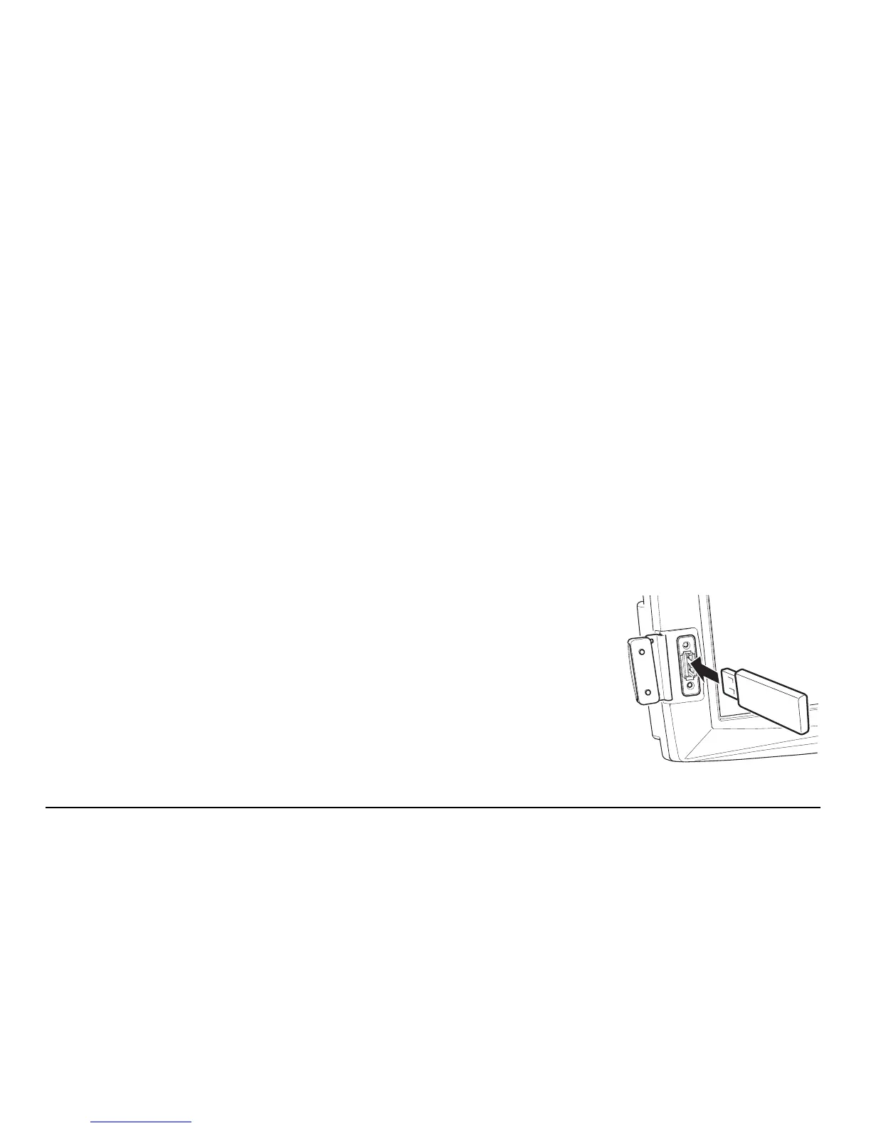
1. The USB interface is on the lower left front of the
mojo3D display. Lift the rubber cover and insert a
compatible USB Flash Drive that contains the
wayline data into the USB slot.