Line Scan
RD1500 Operation Manual 36 © Radiodetection 2016
Section 8 - Line Scan
Line Scan mode allows the operator to acquire data along a straight line and examine it as a
cross-section image. The operator can locate a feature and easily back-up and mark the
location of that object on the ground. Line Scan mode can be used to identify the alignment of
subsurface features, check for linearity and acquire accurate depth measurements.
If you have the RD1500 Enhanced, ensure you are in the appropriate project before entering
this mode.
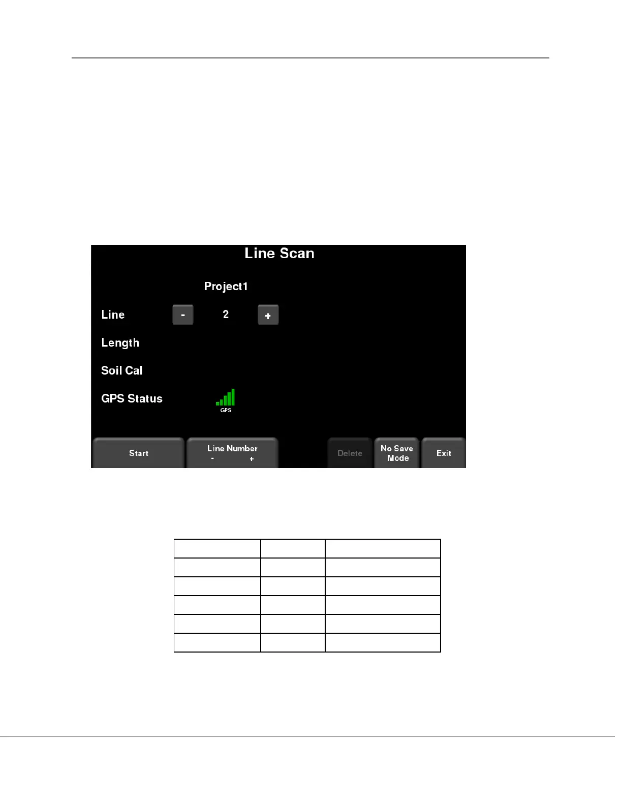
From the main screen, press the Line Scan button; you will see the screen shown in Figure 8-1.
Figure 8-1: Line Scan mode
The GPS Status indicates the quality of the GPS signal, which is based on the number of
satellites that it sees. The chart below explains what the colours and bars mean: