Slice View
RD1500 Operation Manual 56 © Radiodetection 2016
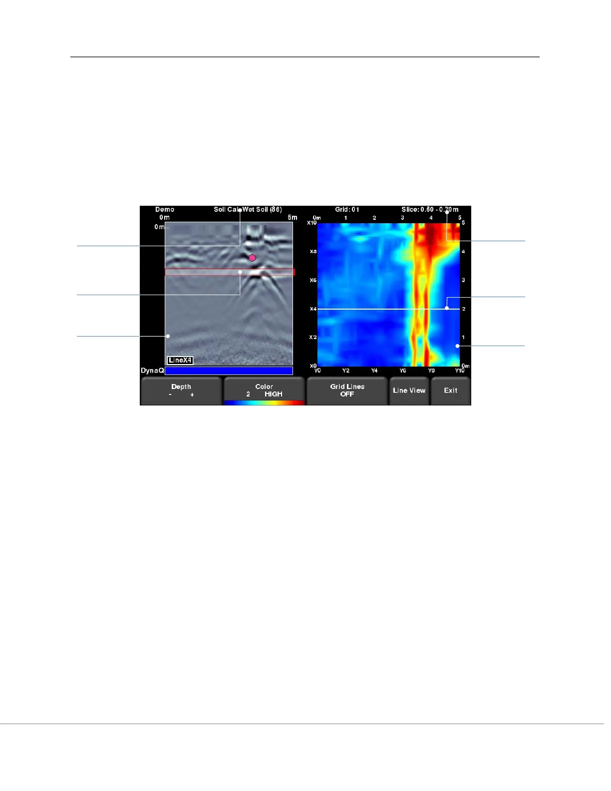
Section 10 - Slice View
Slice View displays data collected in a grid as a series of depth slices moving deeper into the
subsurface. Objects and features appear in plan view, which can be an easier way of visualizing
the data. In addition, data in this view can be exported into other software, such as Google
Earth
TM
.
When you enter Slice View, you will see the screen displayed in Figure 10-1.
Figure 10-1: Slice View screen
The right half of the screen shows one of the depth slices. These slices are 10cm or 4” thick.
The top and right sides of this image show the dimensions of the grid while the left and bottom
sides show the line numbers.
The left half of the screen displays one of the grid lines, and any flags or interpretations that
were made. The shaded area in between the horizontal red lines corresponds to the depth slice
shown on the right. To move to another grid line, use the 4-way directional keypad on the
Display Unit.
At the top of the screen, the grid number is listed, along with the slice thickness range. The Soil
Cal number was automatically determined when the grid data was processed and is also
indicated here.
The button functionality is explained below:
Grid Line
displayed
on left