Current station information
Depending on your cartography, Current station information may be available.
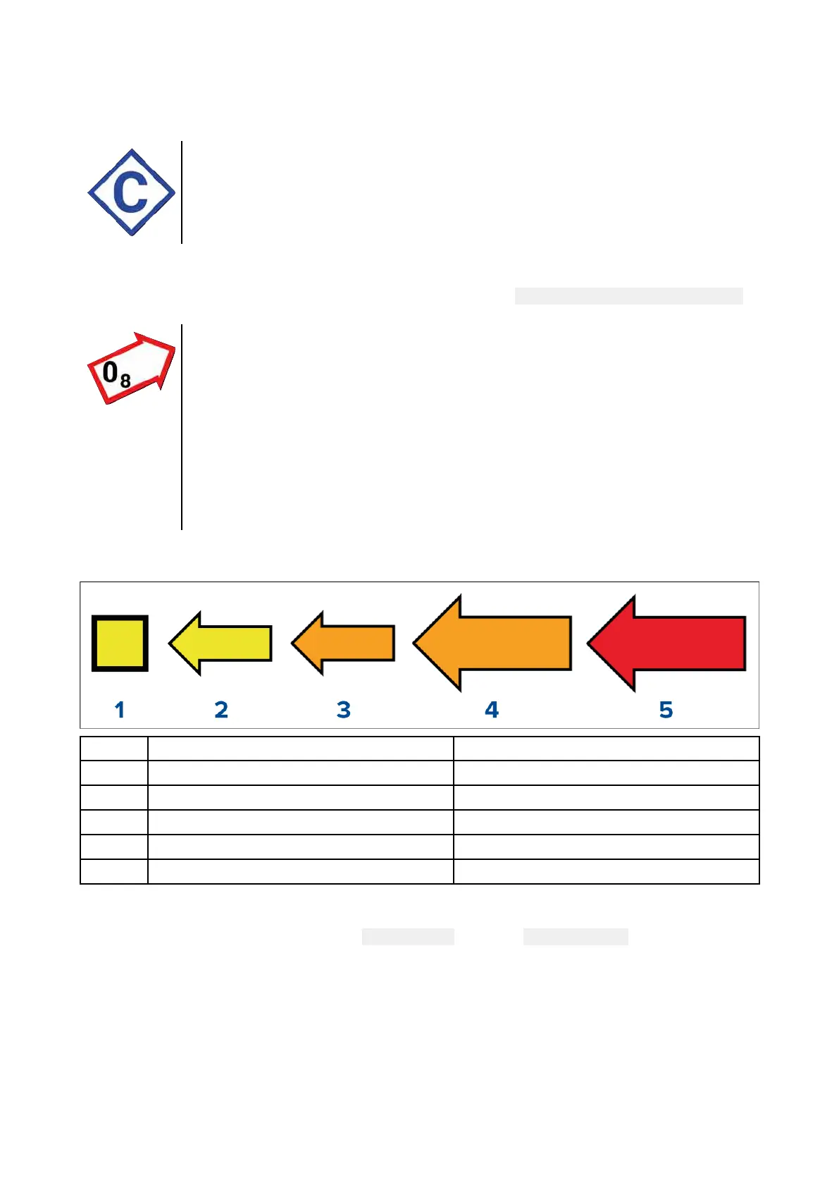
Current station symbol
Current station locations are marked on the chart using a diamond-shaped symbol
with a ‘C’ in the middle.
• The symbol is colored Blue when using applicable Navionics cartography.
• The symbol is colored Black when using applicable C-Map cartography.
Dynamic current graphic
Using Navionics cartography, when the Tides option is enabled (
Menu > Settings > Set-up > Tides),
the current station symbol is replaced with a dynamic current graphic:
The dynamic current graphic is an arrow pointing in the direction of current flow.
Arrow length indicates the speed of the current; the longer the arrow, the faster
the speed.
The arrow’s border indicates current status:
• Red = increasing current speed.
• Blue = decreasing current speed.
Current speed is shown inside the arrow. Current speed is displayed in
user-selected speed units, with decimals displayed in subscript. Decimals are not
shown for values of 10 or greater.
If tidal conditions are “slack”, the word “SLACK” appears in a box with a Blue border.
When using C-Map cartography, arrows are used to indicate the direction of current flow. The size
and color of the arrow indicates the strength of the current:
Color Speed
1 Yellow
0 to 0.1 Knots
2
Yellow
0.2 to 1.0 Knots
3 Orange 1.1 to 2.0 Knots
4
Orange 2.1 to 3.0 Knots
5 Red
>3.0 Knots
Current graph
Current graphs are available by selecting
more options and then Current station from the current
station’s context menu.
94

 Loading...