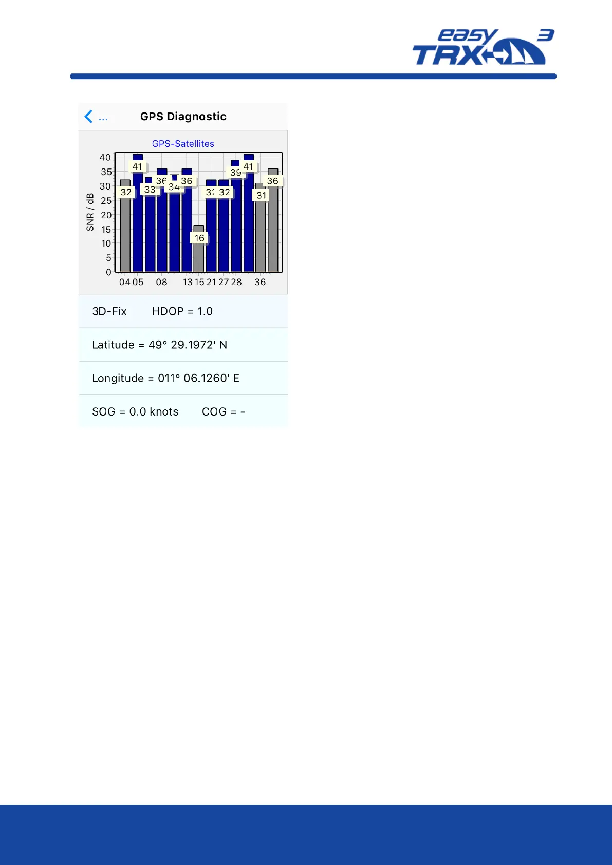
Here an overview is shown about course and
speed over ground, the current position,
satellites available and in use.
Course over Ground:
Displays the current course over ground of
the vessel.
Speed over Ground:
Displays the current speed over Ground of
the vessel.
Latitude / Longitude:
Displays the current exact position of the
vessel.
Satellites in view / Satellites in use:
Displays how many satellites are available
for GPS positioning and how many are used
for GPS positioning in reality.
HDOP:
The horizontal dilution of precision display
is a term used in satellite navigation and
geomatics engineering to specify the
additional multiplicative effect of
navigation satellite geometry on positional
measurement precision. The HDOP
benchmark is 2.5. As lower the value, as
better it is.
Within the picture below you can see a
HDOP value of 1.0 which is very good.
 Loading...