IFD400 Series Pilot Guide
3-24 Map Subsystem
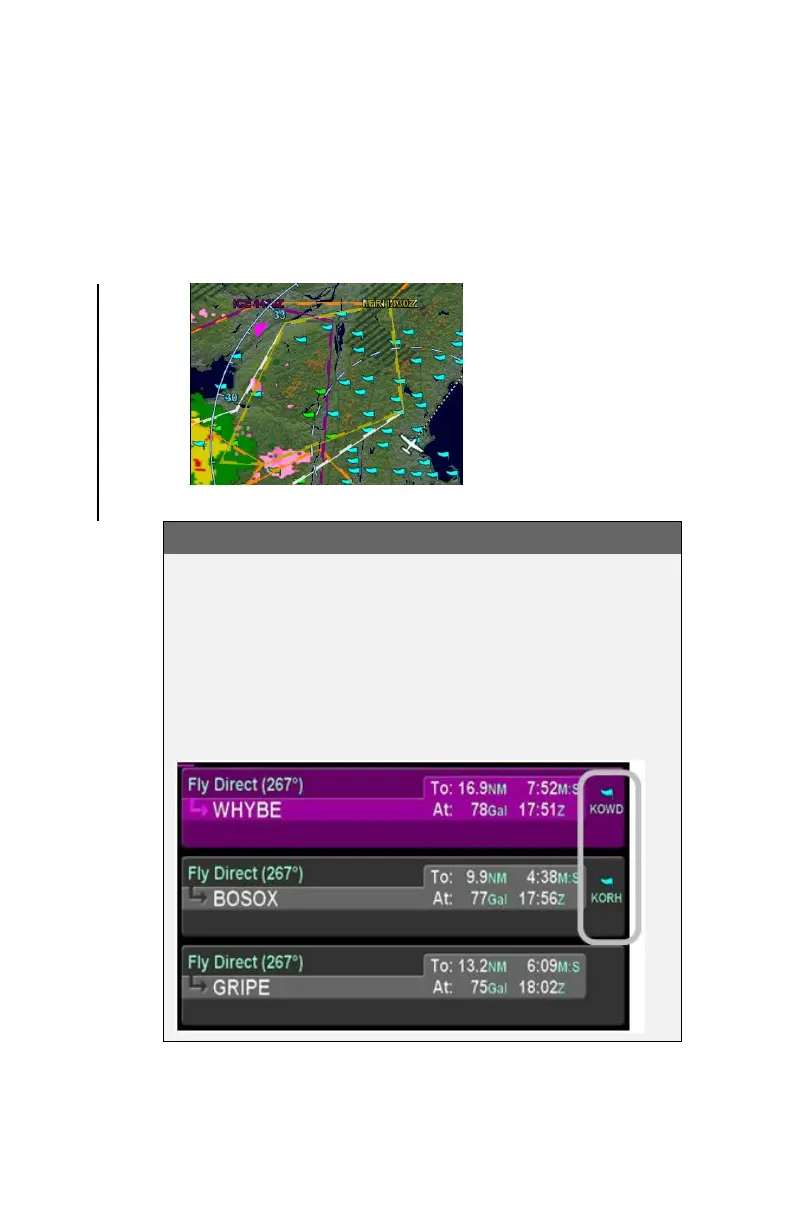
AIRMETs and SIGMETs (US only) – These are areas where
the National Weather Service has issued advisories for
various types of hazardous weather. They are depicted on
the Map page along with an abbreviated description of the
hazard, such as “ICE” (icing), “MTN” (mountain obscuration),
or “IFR” (instrument flight conditions).
AIRMETs and SIGMETs Detail MAP Page
COOL FEATURE
METAR Flags in Flight Plan
The right edge of each leg in a flight plan presents a
METAR flag for the closest reporting station, if the
station is different from the previous leg’s station. The
station for which the METAR flag applies is decoded
immediately beneath the flag and may not be exactly
the same location as the leg itself.