IFD400 Series Pilot Guide
3-38 Map Subsystem
FORWARD LOOKING TERRAIN AVOIDANCE (FLTA)
The IFD comes standard with the “F500” option enabled. When that
option is enabled, the IFD will perform a Forward Looking Terrain
Avoidance (FLTA) function. FLTA is based on GPS altitude, not baro
corrected or radar altitude.
The FLTA function evaluates the aircraft trajectory to determine
areas of conflict with terrain or obstacles. Depending upon proximity
to the aircraft, FLTA classifies conflict areas as “caution” or
“warning”, with warning representing the more immediate threat.
When FLTA has identified a conflict warning or caution area, the IFD
will issue a CAS warning or caution message for the most imminent
threat based on whether the conflict is with terrain or with an
obstacle. An aural alert will accompany the CAS message, based on
the Setup Page selection (see page 4-64).
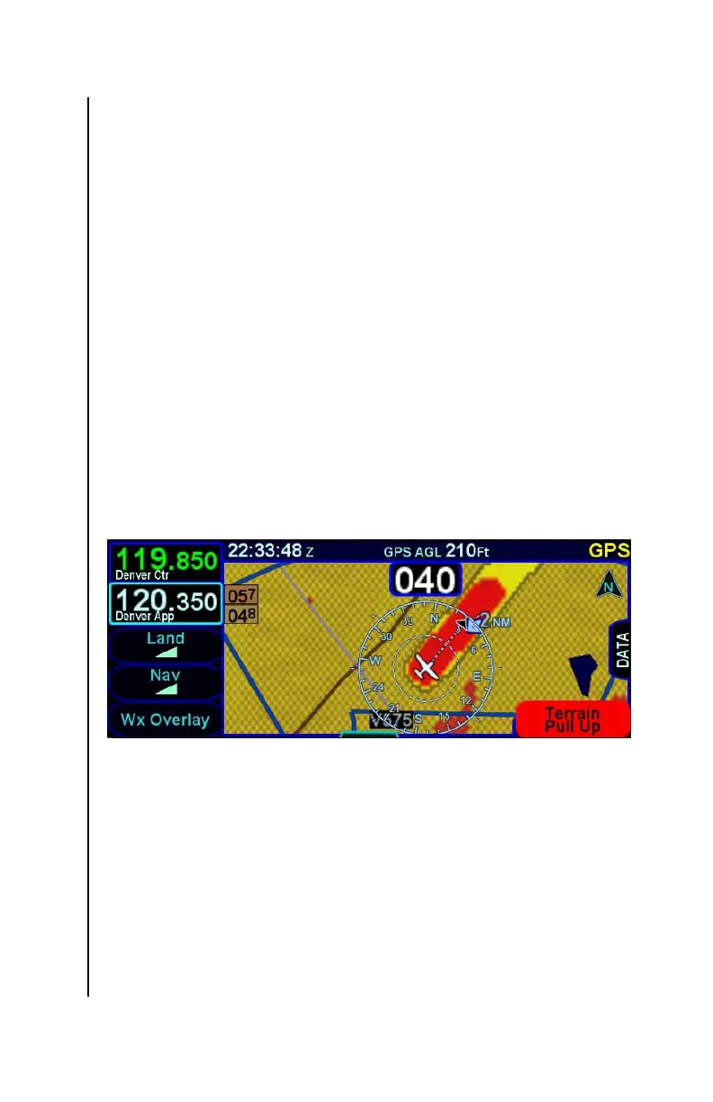
On the map, FLTA caution and warning areas are depicted as solid
yellow and red regions, respectively, as illustrated in the figure below.
FLTA Depiction (solid red and solid yellow)
The area immediately surrounding an airport is considered an FLTA
“exclusion area”. If the aircraft position or an FLTA conflict area is
anywhere within that exclusion area, the IFD will not generate the
typical FLTA caution or warning alerts. At an airport with no known
runways, the airport exclusion area is a 1nm radius circle
surrounding the airport reference point. For each known runway at
an airport, an exclusion area extends 1nm past each end and
0.75nm on each side of the centerline. Therefore, at an airport with
multiple runways, the airport exclusion area comprises the exclusion
area for every runway.