Do you have a question about the Flymaster LIVE C and is the answer not in the manual?
The Flymaster utilizes an external antenna precisely tuned to the Flarm board circuit for optimal system function.
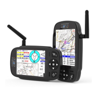
Be sure to install the antenna, tightening it to the end of the thread securely in a clockwise direction.
Force a shutdown by pressing the power button together with Menu/Esc for 2-3 seconds.
Use cursor/pan keys to choose options and the Enter/mark key to select.
Use Map pan keys (up/down) to choose options; Enter/mark key to select.
Provides a graphical indication of the current battery level.
Provides a graphical indication of the current volume level.
Indicates the communications with servers via LTE, showing signal quality and connection status.
Forces navigation to the selected waypoint, overriding task navigation.
Allows the user to add a new waypoint to the list, using current GPS position.
Allows adding a waypoint to the Task by scrolling and pressing Enter.
Allows editing the characteristics of a waypoint within the active task.
Allows viewing information about previous saved flights, with details displayed on Enter.
Indicates if reaching the GOAL is possible based on arrival goal and glide ratio.
Alarm or voice warning indicating approaching or crossing a turnpoint.
Indicates that the start time has elapsed and the start is open.
Warns the pilot if deviating from the ideal route.
Warns the pilot upon entering a buffer zone close to an airspace.
Warns the pilot when approaching or entering a defined altitude limit.
Allows setting a specific altitude alarm independently of airspaces.
Allows choosing between Male and Female voice assistant.
Defines the interface language.
Sets altitude units to Meters or Feet.
Sets speed units to Km/h, Knots, or Miles per hour.
Resets all parameters to default factory values, losing user settings.
Restarts the GPS module for a 'cold start'.
Defines instrument behavior after detecting an eventual landing.
Sets the default turnpoint cylinder size for task creation.
Sets the datum model (WGS 84 or FAI sphere) for distance reporting.
Defines the minimum GPS speed required to initiate flight.
Turns on all Airspaces functions, including warnings and map layer representations.
Sets minimum horizontal distance from an airspace to avoid warnings.
Sets minimum vertical distance from an airspace to avoid warnings.
Displays recorded waypoints from the Flymaster Link app.
Allows importing pre-created waypoints files in .WPT or .GPX format.
Displays recorded tasks from the Flymaster Link app.
Allows scanning a Task using a QR code generated by another instrument.
Allows importing a task from a file with .XCTSK extension.
| Resolution | 320 x 240 pixels |
|---|---|
| GPS | Yes |
| GPRS | Yes |
| Altimeter | Yes |
| Vario | Yes |
| Thermometer | Yes |
| Accelerometer | Yes |
| Gyroscope | Yes |
| Compass | Yes |
| Backlight | Yes |
| Input Voltage | 5V |
| Operating Temperature | -10°C to 50°C |
| Storage Temperature | -20°C to 60°C |
| Certification | CE, FCC |
| Connectivity | Bluetooth |