16 GPSMAP 4000 Series Owner’s Manual
uSInG chartS
USinG
ChartS
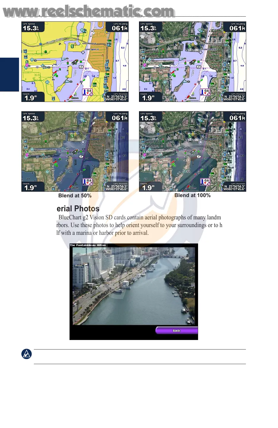
Blend at 50%
Blend at 100%
Photo Overlay Off Land Only Photo Overlay
Viewing Aerial Photos
Preprogrammed BlueChart g2 Vision SD cards contain aerial photographs of many landmarks,
marinas, and harbors. Use these photos to help orient yourself to your surroundings or to help
acquaint yourself with a marina or harbor prior to arrival.
Aerial Photo
NOTE: Use the RANGE (+/-) keys to zoom in and out while viewing the aerial photo on the full
screen.
www.reelschematic.com
www.reelschematic.com