G-858BP Backpack Mag Operators Manual
Features
The G-858BP has been designed to greatly simplify magnetic surveying. All of its features are
intended to speed up the surveying process and reduce the possibility of mistakes. Toward that end, the
following features have been incorporated into the G-858BP:
• Continuous surveying, where the
unit automatically records data at
a user-selectable rate, up to 10
readings per second.
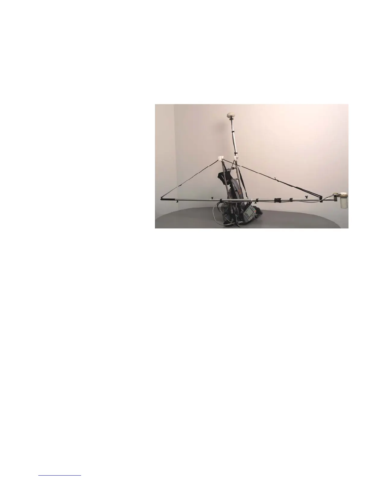
Figure 2 G-858BP with forward staff deployment mode (UXO survey)
• Integrated NovAtel Smart
Antenna™ GPS or Novatel Smart
V1 (with Omnistar differential
correction) is preconfigured,
Lat/Long data recorded
simultaneously with the magnetic
data. Used to produce a located
survey map and exportable
interpolated data set using the
supplied MagMap2000™ program
or KMZ Google Earth™ map
using MagPick™.
• Audible tone and visual data
indicating value of GPS fix
• Discrete surveying option where
the unit takes a reading upon an
operator key-press.
• Four modes of continuous
operation: search mode, for performing a random search for anomalies or system test; simple survey,
for a simplified method of operation with Line and Station marking; mapped survey, for the full
capability of defining X-Y location and tracking position as readings are taken; and base station, for
collecting data to be used for diurnal corrections. GPS is stored in Simple, Mapped and Base Station
modes.
• Real-time analog waterfall display of the current magnetometer reading.
• Up to five separate surveys may be stored independently for up to 6 to 8 hours of recorded data with
GPS.
• Map display showing the X-Y survey area, with readings plotted in the correct X-Y locations.
• Data profile displays, allowing previous data to be reviewed on line by line basis.
• Data editing capability, where data may be deleted and retaken.
• Uploading of data in compressed format to a host PC.
• MagMap2000 software for editing data positions, GPS positions, doing diurnal corrections, filtering,
de-spiking, de-striping and drawing profiles and contour maps.
• Writing out a file for plotting profiles and surface contours with Geometrics or 3rd party software,
such as MagPick™, Surfer™ or GeoSoft Oasis™.
• Audible tones indicating the field change over the local target, QC warning of questionable data,
indication that data was taken and stored, and that location keys have been pressed.
• Storage capacity for more than 250,000 readings and positions, each recorded with the time of the
event and position, including internally or time synched externally logged GPS positions.
• Logging of user-defined field notes.
2
 Loading...