G-858BP Backpack Mag Operators Manual
Chapter 1: Introduction
Overview
The model G-858BP Backpack Mag is a
professional quality magnetic mapping tools offering
exceptional speed and efficiency. The system can be
configured for use in the both the geological survey
mode (for producing detailed magnetic maps for
exploration of minerals, oil/gas, diamonds as shown
on the right in Figure 1) as well as for search and
detection of man-made structures, artifacts and UXO
(see staff mode shown in Figure 2). Data is stored in
non-volatile memory for playback review and
uploading into a host PC. The system includes a
comprehensive software package to download, edit
and interpolate magnetic data into contour-ready
formats. Hard copy annotated color maps can be
produced within minutes after data transfer to the base
computer.
The G-858BP includes three unique X-Y
features, each intended to assist the collection of
magnetic data. First, the system lets you visualize the
survey area beforehand in Mapped Mode X-Y space,
entering in the desired survey corner location points.
Second, it lets you review your X-Y locations and
your data during the survey (Note GPS Latitude
Longitude information is stored but not displayed).
The system presents a “Quick Look” to the operator of
up to 5 stacked survey profiles for quality control
purposes. Finally, the unit allows you to edit X-Y
position and magnetometer data, both in the field and
in later processing with MagMap2000.
Applications
The G-858BP Backpack Mag may be
configured in either single sensor or dual gradiometer
mode. It is used for exploration programs for
minerals, oil, gas, diamonds and geologic survey. It
can also be used to locate waste dumps, buried drums
or other underground storage containers; to find
pipelines, well-heads and other utilities and to survey
archaeological sites and locate Unexploded Ordnance
(UXO). The fast response of the instrument (10
samples per second) means that the data may be taken
at a brisk walking pace which efficiently covers four
to ten times as much ground per hour as non-cesium
magnetometers. The high sensitivity means that many
potential targets which would have been missed with
other techniques will stand out clearly and
unambiguously.
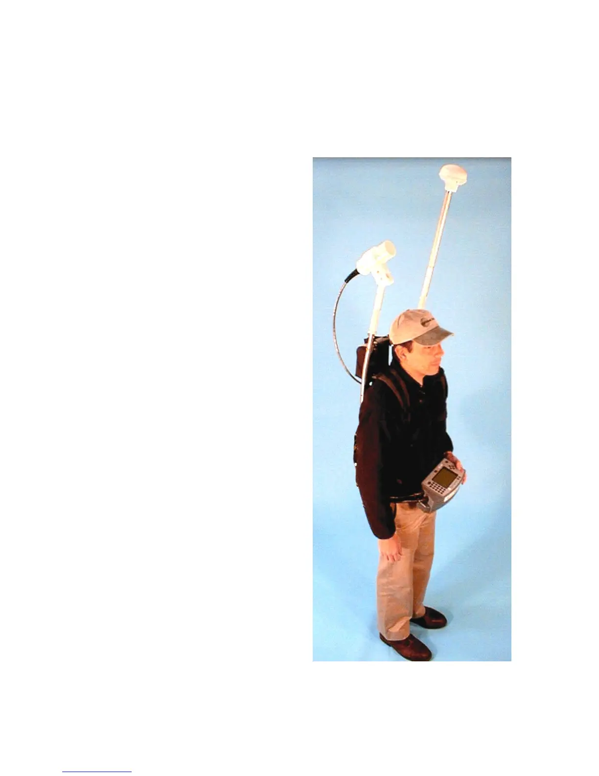
Figure 1 G-858BP Back Pack mode with
sensor at 45 deg for operation in horizontal
1
 Loading...