G-858BP Backpack Mag Operators Manual
MINING MAG MAPPED SURVEY MODE - PARALLEL TO X AXIS
All coordinates are defined as (x,y)
0,100
G-
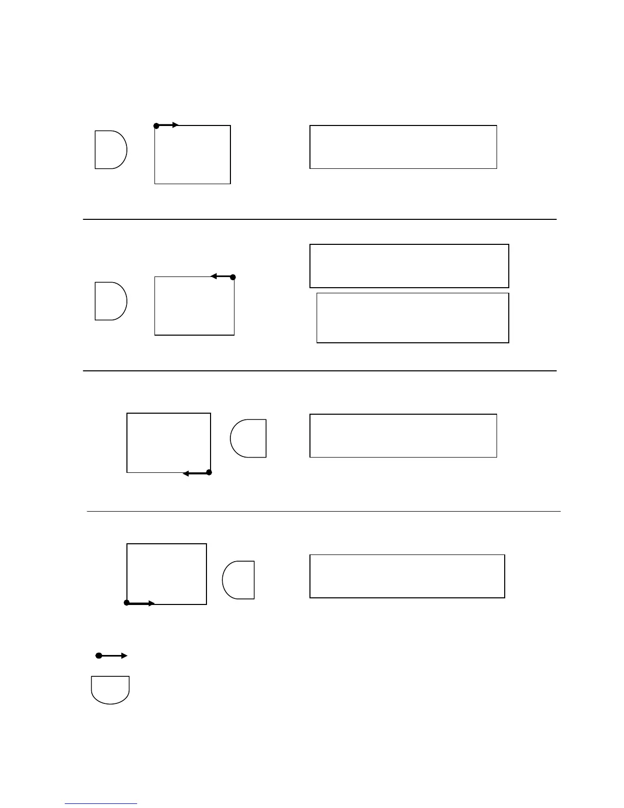
NOTES: UR is Upper Right, LL is Lower Left.
All surveys assume 100 by 100 units. Any rectangular dimension is acceptable.
Represents the start and direction for the first line.
Represents the G-858BP Console orientation
All above Mapped surveys will import into MagMap2000 200 and result in correctly located data.
100,0
LL(0,100) X axis
UR(100,0) Start UP at (0,100)
0,100
LL(100,0) X axis
UR(0,100) Start DOWN at (0,0)
NOT VALID FOR UNIDIRECTIONAL
100,0
0,100
LL(100,0) X axis
UR(0,100) Start UP at (100,0)
100,0
0,100
Survey Area
Survey Area
Survey Area
Survey Area
G-
LL(0,100) X axis
UR(100,0) Start DOWN at (100,100)
NOT VALID FOR UNIDIRECTIONAL
G-
G-
G-
LL
UR
LL
UR
LL
UR
LL
UR
NOTE: Though you are surveying
the area from right to left, the map
a
ears left to ri
ht on the dis
la
.
49
 Loading...