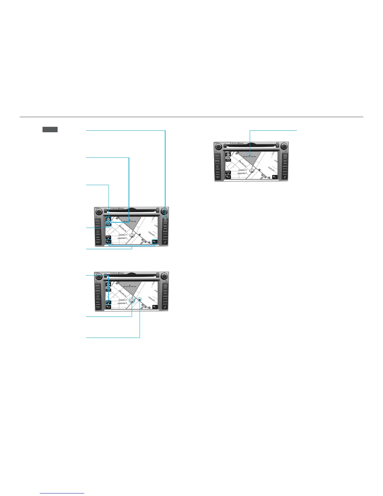
Landmark Icons
Landmark icons are displayed on
the map when the map scale
level is set to under 300 ft(100m-
dependent on map data).
Press the key on the
control panel to display the
current map position.
GPS signal state indicator
Displays the state of GPS signal
reception.
North Up / Heading Up
switch
Displays the current map mode.
The map mode can be switched
between North Up and Heading Up.
Map scale level indicator
Displays the current map scale.
Map scale
Increases or decreases the map
scale.
POI (Point of Interest)
Displays or hides the POI icon on
the map.
Current vehicle position
icon
Displays the current position of
the vehicle.
POI icons
POI icons are displayed on the
map when the map scale level is
set to under 0.5 mi (800m).
MAP
VOICE
21
Map functions
20
 Loading...