3-8 NAVIGATION SYSTEM
PART 3 NAVIGATION SYSTEM
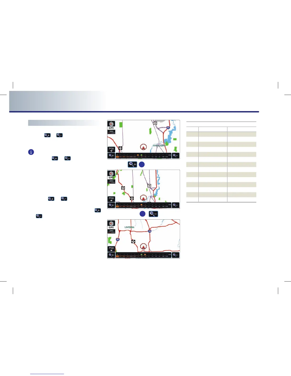
Changing the map scale
Press the
or
button. The map scale
will be increased or decreased by one level.
INFORMATION
Each time the
or
button is pressed,
the scale bar will be displayed.
The scale can be changed by directly pressing
the scale level on the scale bar.
The green color on the scale bar indicates the
current scale level while the orange color indi-
cates the selected scale level.
●
Press the
or
button for over 0.8
second. The scale will continuously change.
●
If the scale range limit is reached, the
or
button will be disabled.
●
The map scale range is between 1 and 14:
10,240,000 ~ 1 : 5,000.
Actual distance
Level
mi / ft km / m
1 150 ft 50 m
2 300 ft 100 m
3 700 ft 200 m
4 0.25 mi 400 m
5 0.5 mi 800 m
6 1 mi 1.6 km
7 2 mi 3.2 km
8 4 mi 6.4 km
9 8 mi 12 km
10 16 mi 25 km
11 32 mi 50 km
12 64 mi 100 km
13 130 mi 200 km
14 250 mi 400 km
 Loading...