IFD400 Series Pilot Guide
4-14 Aux Subsystem
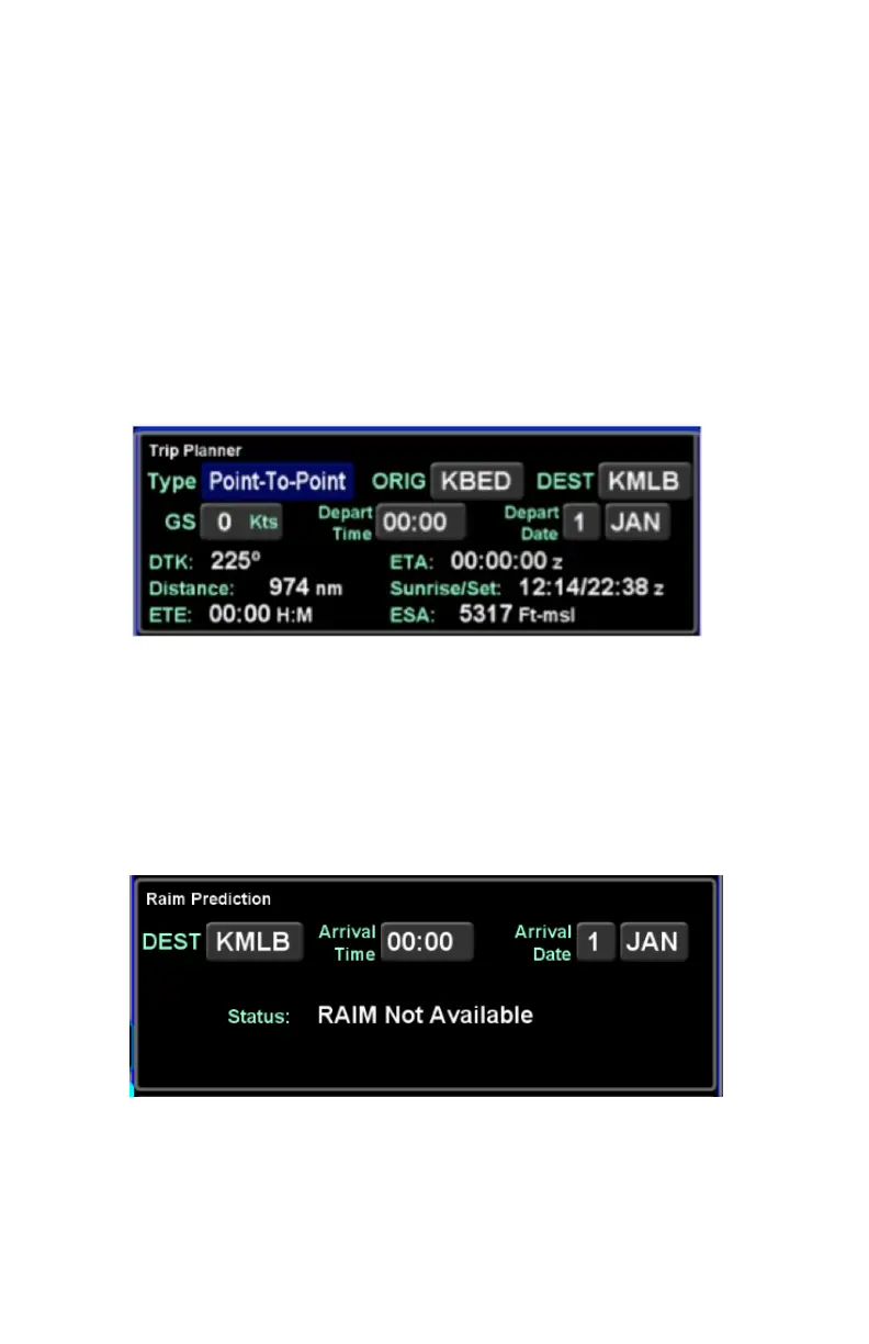
takeoff) and departure date and will produce values (straight line
connecting start/end) for desired track, distance, ETE, ETA,
sunrise and sunset, and enroute safe altitude (ESA) - defined as
1000’ above the maximum elevation of displayed terrain
(including obstacles) within a rectangular grid that measures 10
miles on each side of the centerline of the active leg or portion of
the active leg that is currently displayed on the Map page.
The “Type” field choices are “Present Position” or “Point-to-Point”.
If Point-to-Point was selected, then there is also a field for origin.
Trip Planner Calculator
RAIM Prediction
The GPS RAIM (Receiver Autonomous Integrity Monitoring)
Prediction calculator includes fields for destination, arrival time
and arrival date and will produce a RAIM status value for the
destination location.
RAIM Prediction Calculator