iv
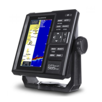
GPSMAP
®
585 Plus
Showing the VRM and EBL .......................................................................... 39
Measuring the Range and Bearing to a Target Object ......................... 40
AIS Radar Appearance Settings ........................................................... 40
Highway Page ...................................................................40
Opening the Highway Page .................................................................. 40
Showing and Customizing the Highway Overlay Numbers ................. 41
Auto Guidance .................................................................41
Auto Guidance Path Congurations ..................................................... 42
Adjusting the Distance from Shore ....................................................... 42
Digital Selective Calling ..................................................44
Networked Chartplotter and VHF Radio Functionality ......................... 44
Turning On DSC.................................................................................... 44
DSC List ................................................................................................ 44
Viewing the DSC List ....................................................................................44
Adding a DSC Contact ..................................................................................44
Incoming Distress Calls ........................................................................ 44
Navigating to a Vessel in Distress ................................................................ 44
Position Tracking ................................................................................... 44
Viewing a Position Report .............................................................................44
Navigating to a Tracked Vessel ....................................................................45
Creating a Waypoint at the Position of a Tracked Vessel ............................45
Editing Information in a Position Report ....................................................... 45
Deleting a Position-Report Call ....................................................................45
Viewing Vessel Trails on the Chart ............................................................... 45
Individual Routine Calls ........................................................................ 45
Selecting a DSC Channel ............................................................................. 45
Making an Individual Routine Call ................................................................46
Making an Individual Routine Call to an AIS Target .....................................46
Tide, Current, Lunar Calendar, and Celestial Information
46
Celestial Information ............................................................................. 46
Viewing Information for a Different Tide Station ................................... 46
Lunar Calendar ..................................................................................... 47
Device Conguration .......................................................47
GPSMAP 585 Plus Settings Menu Tree ............................................... 47
System Settings .................................................................................... 49
System Information ....................................................................................... 49
My Vessel Settings ................................................................................ 49
Setting the Keel Offset .................................................................................. 50