G-858BP Backpack Mag Operators Manual
In this case, you would enter the coordinate (10, 60) as the lower left corner of the display, and (50,
20) as the upper right corner of the survey. You would also set the unit to survey parallel to the X axis.
You can visualize this by rotating the G-858BP clockwise 90 degrees and placing it on the map. For the
sub-survey shown, the line spacing is now 20, and the mark spacing 10.
Note: Two things must be remembered in setting up the coordinate systems.
First, the line direction is always up and down the G-858BP display.
Secondly, lines are surveyed starting from the left of the display, and moving
toward the right of the display.
180 Degree Orientation
Please note that the G-858BP allows you complete freedom in where to start your survey, even though
the lines always must move from left to right on the display. You can always rotate the G-858BP until the
line direction is up and down, and the lines move from left to right. This rotation will determine what
coordinate you must enter as the lower left and the upper right of the display. Some orientations will
require that you start the survey in the upper left corner of the display. This can be set in the Map Setup
Menu before starting the survey.
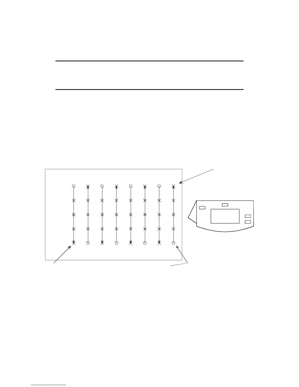
This can be seen in the following example. Suppose you are back to the original survey, shown in
Figure 1, but you wish to start in the lower right corner of the site.
Line No.
0
1
2
34
5
6
7
0
20
40
60
80
0
10
20
30 40
50
60
70
X Coordinate
Y Coordinate
Start survey here
lower left corner of display
upper right corner of display
This can be accomplished by rotating the G-858BP 180 degrees relative to the site map. Then you
can see that the correct lower left coordinate is (70, 80), while the upper right coordinate is (0,0). The
survey should be begun in the upper left corner of the display.
58
 Loading...