Chapter 1: Operation 7
Heading chapter
TRUE WIND
(speed)
True wind speed, in either kilometers per hour KMH), meters per second
(
M/S), or knots (KTS).
TRUE WIND
(angle)
True wind angle, in degrees.
GROUND
WIND
Direction of wind over ground, in degrees, either MAG(netic) or TRU(e).
WIND FORCE
Wind speed as a Beaufort scale value and wind direction as a cardinal compass
point.
A WIND (graph) Apparent wind speed in either kilometers per hour (KMH), meters per second
(
M/S), or knots (KTS), displayed against time, as a graph.
A WIND ANG
(graph)
Apparent wind angle information in degrees, displayed against time, as a graph.
T WIND (graph) True wind speed in either kilometers per hour (KMH), meters per second (M/
S
), or knots (KTS), displayed against time, as a graph.
T WIND ANG
(graph)
True wind angle in degrees, displayed against time, as a graph.
WIND DIR
(graph)
Ground wind direction in degrees, displayed against time, as a graph. Shown as
either
T(rue) or M(agnetic).
Page Remarks
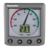
HEADING Current heading, in degrees, either TRUE or MAG(netic).
HEADING Shows whether the heading is LOCKED or UNLOCKED.
TACK COURSE Next tack heading, in degrees, either TRUE or MAG(netic).
COG Course over ground, in degrees, either TRUE or MAG(netic).
COG
HDG
Dual page showing course over ground and current heading
Page Remarks
81268_3.book Page 7 Tuesday, August 1, 2006 8:05 AM