38 | Operation
The data source when operating in NAV mode is the
Navigation (Nav) source. It is normally the same as the
Position source (GPS/Chart plotter) see page 57.
Navigational steering should only be used in open waters.
When selecting NAV mode, the AP28 maintains the
current set course and prompts the user to accept the
course change towards the destination waypoint.
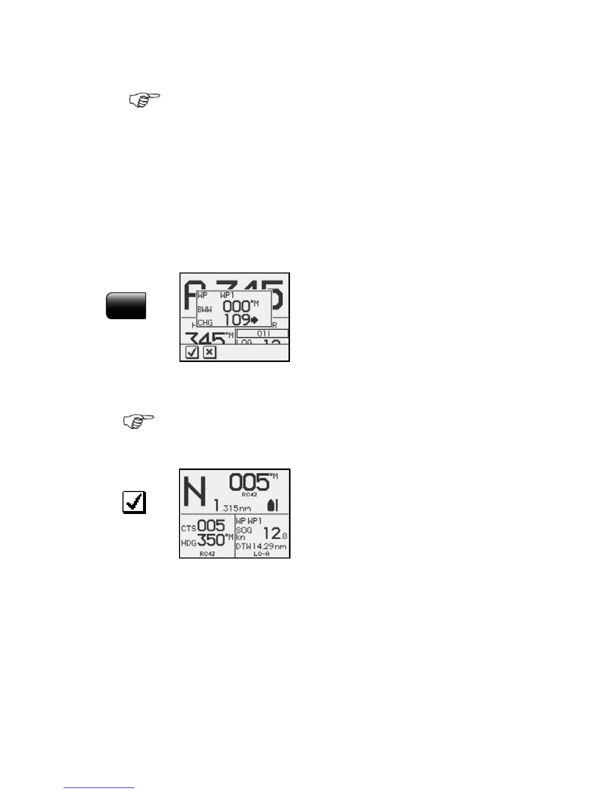
Press the NAV key to activate the NAV prompt display.
NAV
The prompt display shows the
name of the next waypoint (WP),
the bearing of the track line
(BWW) from the previous
waypoint to the destination
waypoint, the required course
change (CHG) and the direction
in which the boat will turn.
If only one waypoint has been entered the bearing will be
from the present position to the destination waypoint.
• NAV mode
• Course to steer (CTS): 005 is
set internally by the autopilot
to steer the boat onto the track
line and maintain the bearing
• Cross Track Error (XTE): 1.315
nm
• Boat symbol illustrating whether the boat is to port or
starboard of planned track
• Compass heading: 350° M
• Next waypoint: WP1
• Speed over ground (SOG): 12.8 kn
• Distance to next waypoint (DTW): 14.29 nm
• Steering parameter: LO-A
 Loading...