• Loading the field border at the beginning of
tilling the field.
• Worked area (field border with worked area
of the field), if work has been interrupted
and is now being resumed.
• Lead track for GPS-Track
• Obstacles
• Exclusion zones
• Application maps
• Headlands
→ Field data which cannot be called up are
shown in grey.
ο Only fields in the set radius
are displayed - see page 55.
ο
Display all fields.
, Select desired field
or
ο
search for field after entering a
text passage.
5.
Confirm selection.
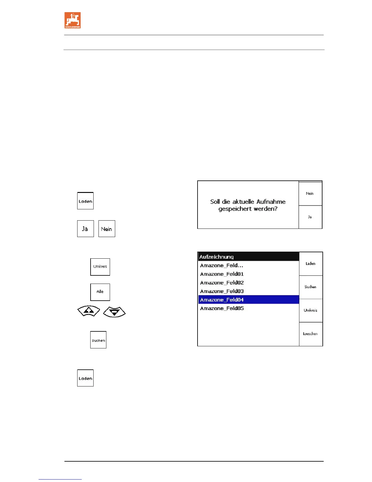 Loading...