146 G12 OEM Board & Sensor Reference Manual
The ECEF coordinates reported are in the datum set by the user. ECEF coordinates are reported in
meters (with two decimal places) without leading zeros or positive signs.
GDC: Grid Coordinates
$PASHS,NME,GDC,c1,s,[f]
This command enables/disables the $PASHR,GDC message.
c1 is the port designator (A or B) for message output. s3 is ON or OFF. f is the
optional message output rate ranging from 0.05 to 999 seconds depending on the
measurement update rate option installed.
If the command is set without a period, the G12 uses the period set by the
$PASHS,NME,PER command If the $PASHS,NME,PER command is issued after
this message period has been set, the period resets to the PER setting.
$PASHQ,GDC,[c]
The associated query command is $PASHQ,GDC,c, where c is the optional output
serial port. The message is not output unless position is being computed.
The response is in the format:
$PASHR,GDC,m1,s2,f3,f4,d5,d6,f7,f8,M,f9,M,d10,s11,s12*cc
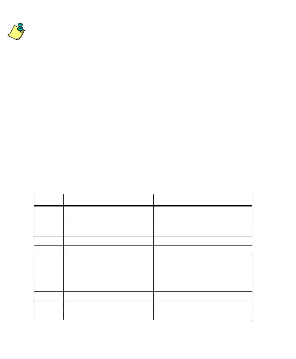
Table 4.72 defines the GDC message format:
Table 4.72. GDC Response Message Format
Parameter Description Range
m1 UTC of position in hours, minutes, and
decimal seconds (hhmmss.ss)
0 - 235959.90
s2 Map projection type EMER, TM83, OM83, LC83, STER, TM27,
TMA7, LC27
f3 East (X) User Grid coordinate (meters) ±9999999.99
f4 North (Y) User Grid coordinate (meters) ±9999999.99
d5 Position indicator
1: Raw position
2: RTCM differential, or CPD float
solution
1, 2, 3
d6 Number of GPS satellites being used 3 - 12
f7 Horizontal dilution of precision (HDOP) 999.9
f8 Altitude in meters ±99999.999
M Altitude units (M = meters) M
G12RevD.book Page 146 Tuesday, April 2, 2002 4:33 PM