106 G12 OEM Board & Sensor Reference Manual
UDG: User-Defined Datum-to-Grid, Extended Memory G12 Only
$PASHS,UDG,s1,d2,f3,f4,f5,f6,f7,f8,f9,f10,f11,f12,f13
This command allows you to set parameters to transform geodetic coordinates
specified by the UDD command to grid coordinates. The G12 performs the
transformation internally. The number of UDG parameters required for the
transformation depends on the type of map projection selected, and must be
indicated by the user in the d2 parameter.
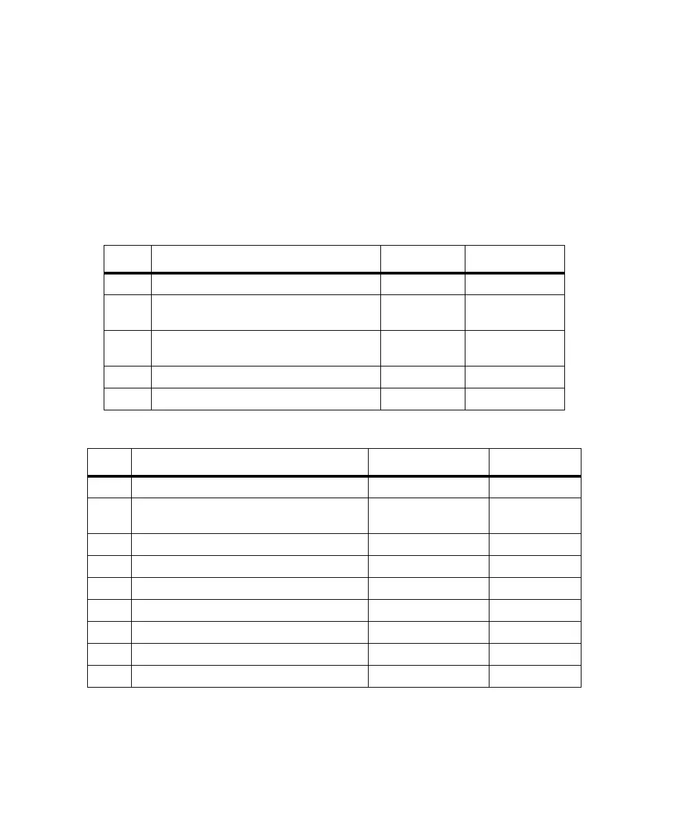
Table 4.47 through Table 4.54 lists the parameters for each map projection:
Table 4.47. UDG Structure for Equatorial Mercator
Field Description Range / Name Units
s1 Map projection type EMER n/a
d2 Number of parameters for the selected
projection
3n/a
f3 Longitude for the Central Meridian ±1800000.000
0
dddmmss.sss
f4 False Northing ±10,000,000 meters
f5 False Easting ±10,000,000 meters
Table 4.48. UDG Structure for Transverse Mercator
Field Description Range / Name Units
s1 Map projection type TM83 n/a
d2 Number of parameters for the selected
projection
5 or 7 (last 2 optional) n/a
f3 Longitude for Central meridian ±1800000.0000 dddmmss.ssss
f4 Scale factor at Central Meridian 0.5 to 1.5 n/a
f5 Latitude of the grid origin of the projection ±1000000.0000 ddmmss.ssss
f6 False Easting ±10000000 meters
f7 False Northing ±10000000 meters
f8 Zone width (Default is 6°) 3 or 6 degrees
f9 Zone number at 0° longitude (Default is 31°) 1 to 60 N/A
G12RevD.book Page 106 Tuesday, April 2, 2002 4:33 PM