CHAPTER 2 CONTROLS AND DISPLAY
Page 2-28
091-00027-001 REV A Evolution Backup Display Pilot’s Guide
Page PB
091-00027-001 REV A
Evolution Backup Display Pilot’s Guide
Figure 2-30
Declutter Level 4
Figure 2-31
Declutter Level 3
Figure 2-32
Declutter Level 2
Figure 2-33
Declutter Level 1
Figure 2-34
Declutter Level 0 (O)
Figure 2-29
Map in ARC Compass Mode, 3nm
Range at Declutter Level 0
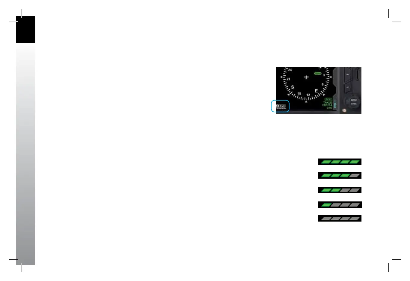
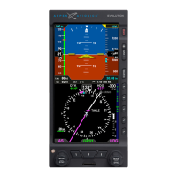
2.3.4.4. Situational Awareness Map
When the EBD is connected to a compatible GPS navigator, basemap symbols can be
displayed underneath the Direction Indicator in either 360º or ARC Compass Modes.
Most GPS navigators output data for the EBD to display the GPS ight plan legs and
waypoints. The active GPS ight plan leg, waypoint, and its identier are shown in
magenta. Other waypoints and legs are shown in white.
Some GPS navigators (typically those using the ARINC 429 data protocol, such as
the Garmin 400/500 series) output basemap data (e.g., airports, VORs, NDBs, and
intersections). Often, these GPS navigators also display curved ight paths, such as arcs,
course reversals, and holding patterns.
The basemap is always oriented with magnetic heading up and centered so that the
current aircraft position coincides with the aircraft ownship symbol. These basemap
symbols underlay all other instruments and annunciations in the Navigation Display.
The Map Declutter Settings can be found in the 360 or ARC MAP SETTINGS page of the
Menu. Pressing the desired 360 or ARC DCLTR LVL Menu Key and rotating the Top Knob
will select Declutter Levels 4, 3, 2, 1, or OFF (Figure 2-30, 2-31 2-32, 2-33, 2-34).
The map display range is controlled by the RNG Button (Figure 2-2, Ref. 2), enabling
the pilot to zoom in or out on the map. Automatic declutter logic changes the map
features displayed depending on the selected maprange.
The current range and declutter level map settings are shown in the lower left-hand
corner of the navigation display (Figure 2-29). The map range is displayed in nautical
miles, measuring the distance from the ownship symbol to the outside edge of the
compass rose. The map declutter level is indicated by one to four green parallelograms
below the range value. More parallelograms indicate that more basemap features are
displayed.
091-00027-001 Rev A EBD Pilots Guide V&H .indb 28 8/27/14 8:51 AM