CHAPTER 4 REFERENCE GUIDE
Page 4-30
091-00027-001 REV A Evolution Backup Display Pilot’s Guide
Page 4-31
091-00027-001 REV A
Evolution Backup Display Pilot’s Guide
Auto Range is only available when a ight plan is active. Since Auto Range uses the
distance between the present position and the next active waypoint to compute the
appropriate map range, if the currently Selected CDI Navigation Source does not have
a valid ight plan, then Auto Range is not selectable. If Auto Range cannot be selected
check:
• To ensure a ight plan is active
• The GPS source with the ight plan is the Selected CDI Navigation Source
• That Auto Range is enabled from the General Settings B Menu page
4.4.5.2. Flight Plan
When a ight plan is provided by a congured GPS, the map shows ight plan
waypoints and legs. The active leg and waypoint and associated identier are displayed
in magenta. Other waypoints and legs are white. Straight and curved ight plan details
are rotated within the map display to maintain their correct relative orientations at
alltimes.
4.4.5.3. Map Data Source and Reversion
If the selected GPS data is unavailable or invalid:
• The associated ight plan and map data are retained and displayed, as long as an
alternate source of position information remains available.
• The ight plan and waypoints become inactive and are displayed in white.
• Position is provided from:
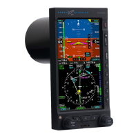
1. The RSM GPS, if enabled, and position data are available. In this case, a RSM
GPS REVERSION EMER USE ONLY annunciation is shown above the Selected
CDI Navigation Source (Figure 4-98).
Figure 4-98
RSM GPS Reversionary Navigation
091-00027-001 Rev A EBD Pilots Guide V&H .indb 30 8/27/14 8:51 AM