IFD500 Series Pilot Guide
Map Subsystem 4-13
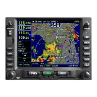
MAP PANNING
Panning the map is accomplished by dragging a finger along the
display in the direction of desired panning. When panning away from
the ownship depiction, a cross-hair cursor is displayed and a readout
of the bearing and distance from present position to the cross-hair
cursor position is displayed next to the cross-hair cursor.
The map will snap back to being centered on the present-position
ownship depiction after 20 seconds of panning inactivity or if a quick
double-tap on the touch-screen is made.
NOTE
Map Panning Limited Geographic Boundaries
Due to map projection limitations, map panning is
limited to +/- 45 degrees of longitude and +/- 30 degrees
of latitude from present position.
NOTE
Map Panning Only Via Touch
Map panning can only be accomplished via touch
screen use. There is no physical bezel control to
support map panning.