5.3 SEA CLUTTERS
yy
yyy
5-5
5
[II] Rain and snow clutter
Rain and snow clutter is a video image that appears in a location where rain or snow is falling. The image
changes according to the amount of rain (or the amount of snowfall). As precipitation increases, the
image of rain and snow clutter becomes intensified on the radar display, and in the case of localized heavy
rain, an image similar to the image indicating land is displayed in some cases. Furthermore, because
radio waves tend to attenuate due to rain and snow, the ability to detect a target in the rain and snow clutter
or a target beyond the rain and snow clutter may decrease. The amount of attenuation depends on the
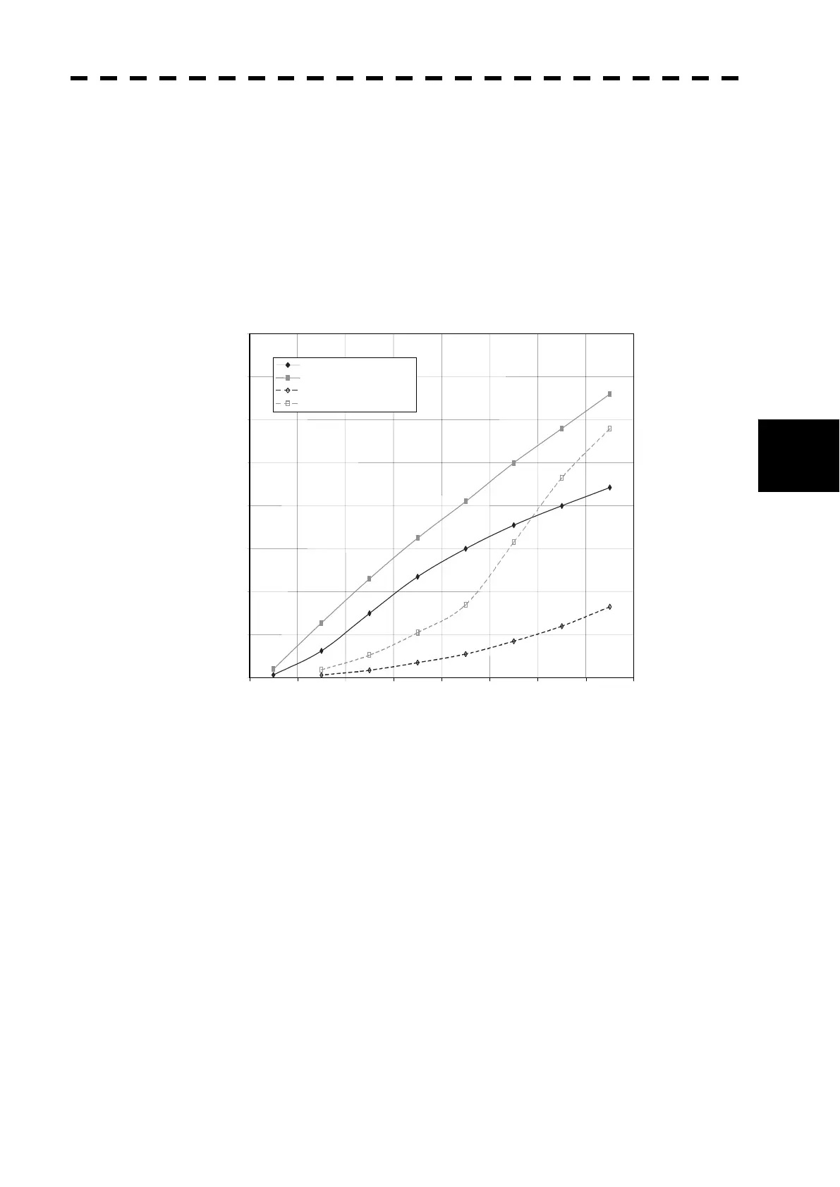
transmission frequency, antenna beam width, and the pulse length. Figure 5.4 shows examples in which
detection distance is reduced due to the influence of precipitation. Because of this, a target, which clearly
appeared up to 10 NM (pulse width of 0.8 Ps) when it was not raining, may become dimly visible up to 5
NM when the amount of rain becomes 4 millimeters per hour.
Figure 5.4 Decreased target detection distance due to precipitation
02468
10
12 14 16
Detection distance while it is not raining (NM)
Precipitation of 16 mm/hr Pulse width 0.05 Ps
Precipitation of 4 mm/hr Pulse width 0.05 Ps
Precipitation of 16 mm/hr Pulse width 0.8 Ps
Precipitation of 4 mm/hr Pulse width 0.8 Ps
Detection distance while it is raining (NM)
0
2
4
6
8
10
12
14
16
 Loading...