188
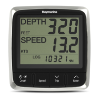
HSB Series LCD Display
CAUTION & ROUTING DATA
Caution AreasCaution Areas
Caution AreasCaution Areas
Caution Areas
Tracks and RoutesTracks and Routes
Tracks and RoutesTracks and Routes
Tracks and Routes
Caution area Deep water route part
Fishing facility Deep water route centreline
Marine farm/culture Fairway
Cable, submarine Ferry route
Cable area Navigation line
Offshore prod’n area Precautionary area
Pipeline Radar line
Pipeline area Radar range
Anchor berth Radio calling
Anchorage area Recommended route centreline
Cargo transhipment Recommended track
area Recommended traffic lane part
Contiguous zone Traffic separation line
Continental shelf area Traffic separation scheme boundary
Custom zone Traffic separation scheme crossing
Dumping ground Traffic separation scheme lane part
Exclusive economic Traffic separation scheme roundabout
zone Traffic separation zone
Fishery zone Two-way route part
Fishing ground
Free port area
Harbour area (administrative)
Incineration area
Log pond
National territorial area
Sea area
Spoil ground
Straight territorial sea baseline
Submarine transit lane
Territorial sea area
Restricted area
Sea Plane landing area
Military practice area
MARINE FEATURES
Tideways & CurrentsTideways & Currents
Tideways & CurrentsTideways & Currents
Tideways & Currents
Seabed bottomSeabed bottom
Seabed bottomSeabed bottom
Seabed bottom
Tideway Sand waves
Water turbulence Seabed area
Tide height Spring
Weed/Kelp
LAND FEATURES
Natural FeaturesNatural Features
Natural FeaturesNatural Features
Natural Features
Cultural FeaturesCultural Features
Cultural FeaturesCultural Features
Cultural Features
LandmarksLandmarks
LandmarksLandmarks
Landmarks
Coastline Airport area Building, religious
Dune Built-up area Building, single
Hill Railway Cemetery
Land elevation Road crossing Fortified structure
Land region Road part Siloway route part
Land Runway Tank
Salt pan Sloping ground Chimney
Slope topline Square Dish aerial
Tree Cable, overhead Flagstaff/Flagpole
Vegetation area Fence Flare stack
Natural Features - Rivers Natural Features - Rivers
Natural Features - Rivers Natural Features - Rivers
Natural Features - Rivers Pipeline, overhead Mast
Canal Pylon Monument
Canal bank Telepheric Radar dome plane landing
Rapids Tunnel entrance area
Appendix C:
C-Map Chart Card
Features

 Loading...


