Appendix 2: Software Specifications
-45-
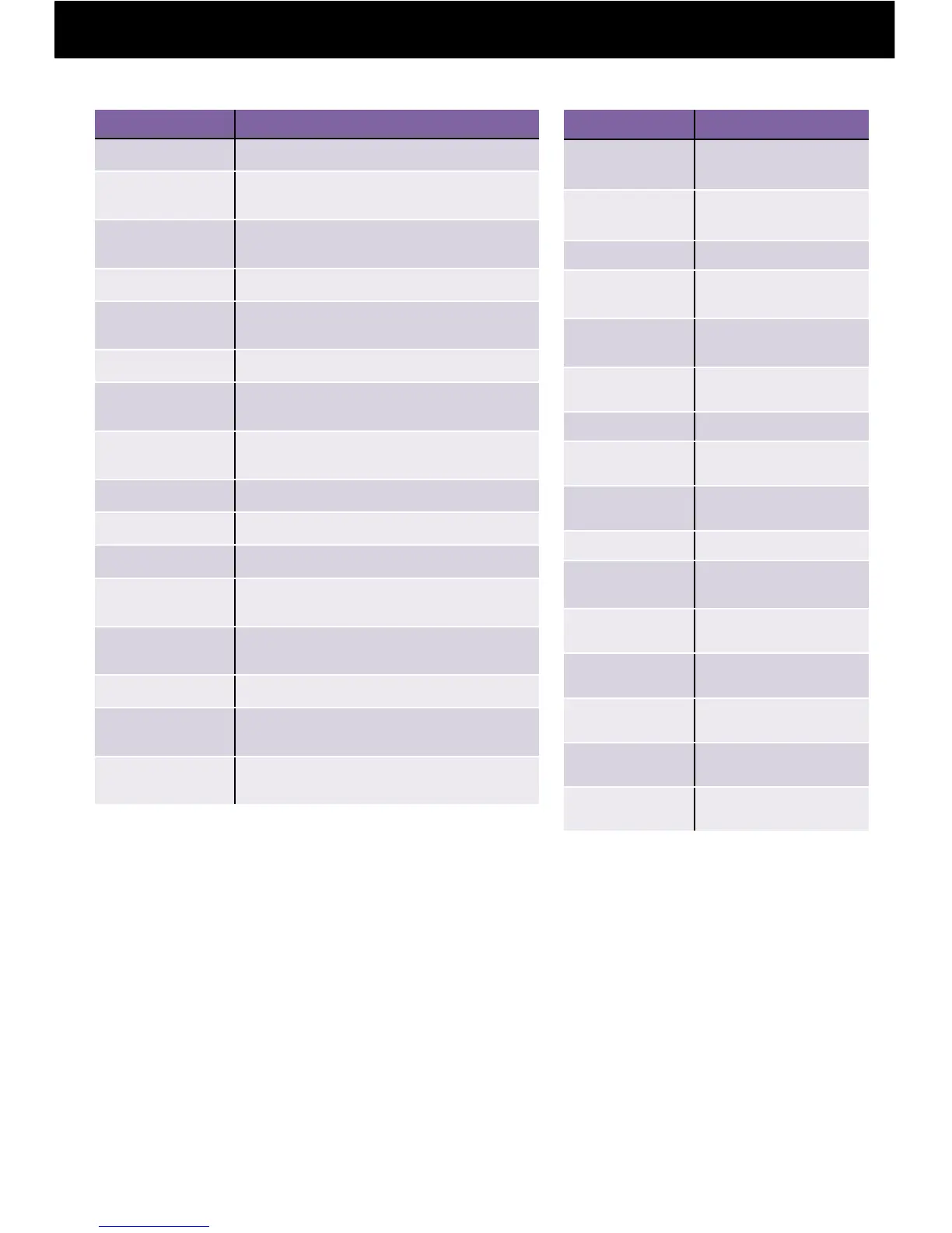
Item Content
Route search Vehicle route, walking route, reroute
Search by
address
Prefecture, municipality, block (chome),
lot number (ban-chi)
Search by
station
JR, private railway, subway, monorail,
etc.
Search by POI Search by category, search periphery
Search by phone
number
Search for phone number by business
Map Code Map code search
Search by set
point
Set points (11 pins × 100)
Set flags Goal point, start point, waypoint, point
mark
Speed camera Audio assist, warning display
Map operation Zoom-out, zoom-in, move, rotate
Map type Birds-eye view, Roman-character map
Map rotation Rotate in the direction of progress, fix
bearing
Map scale 7 steps (25, 50, 100, 150, 250, 500, 1000
m)
Voice guide Japanese, English, and Chinese
Guidance
induction
Course arrow, direction line, road names,
intersection names
GPS info Latitude, longitude, altitude, time, velocity,
etc.
Item
Content
Road net
Main roads, narrow
streets
Address data
4.8 million around
Japan
Station data
10,000 around Japan
POI data
600,000 around
Japan
Phone data
10 million around
Japan
Speed camera
info
700 around Japan
Road names
40,000 around Japan
Intersection
names
70,000 around Japan
Button graphics
etc
545 types
Facility icons
229 types
Voice data
442 types (in 3
languages)
Street DB
content
170 MB
Address DB
content
28 MB
Station DB
content
0.5 MB
Phone DB
content
200 MB
Background DB
content
22 MB