EasyManuals Logo

Simrad GO XSE Series User Manual

Simrad GO XSE Series
242 pages
To Next Page IconTo Next Page
To Previous Page IconTo Previous Page
Page #45 background imageLoading...
Page #45 background image
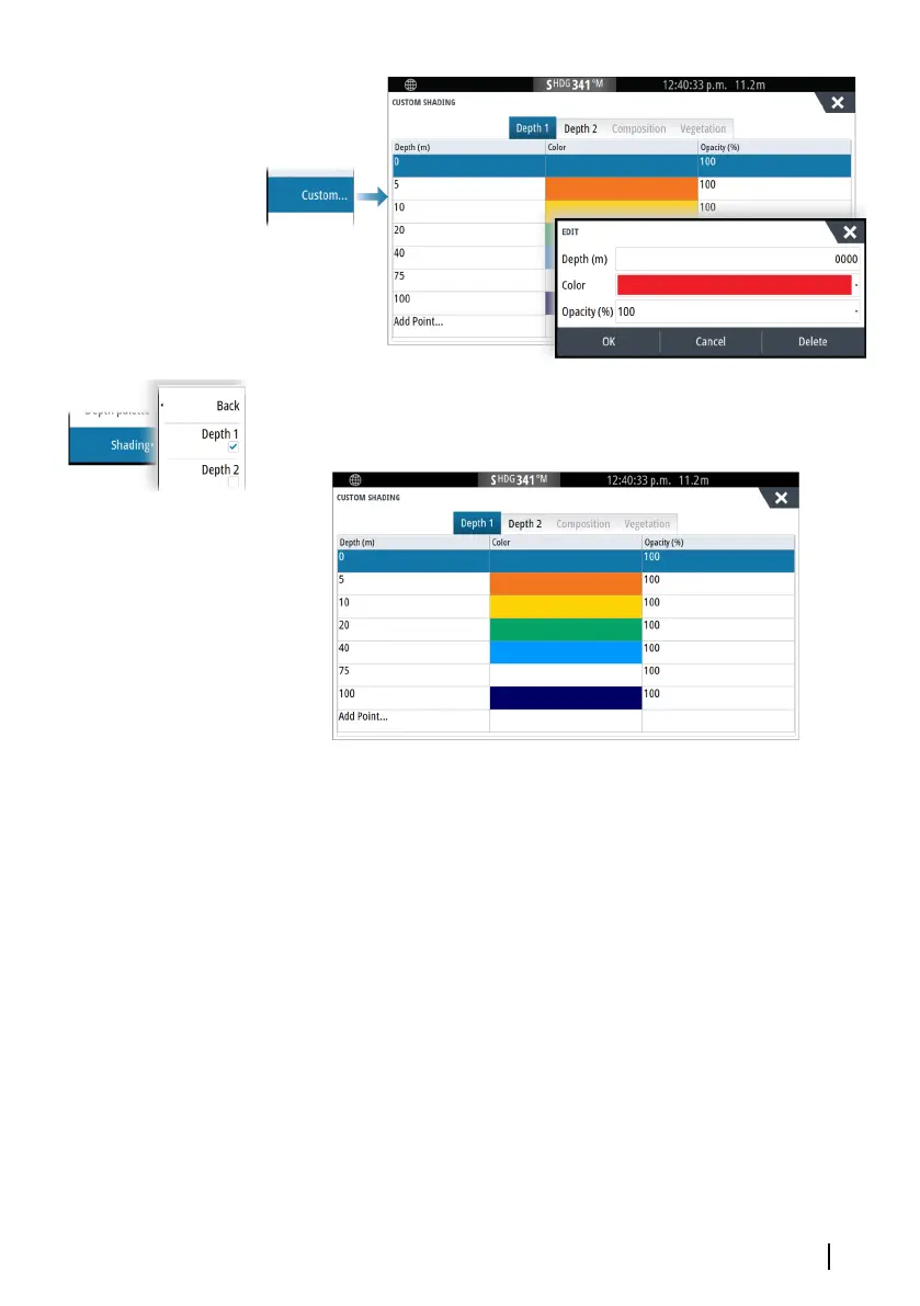
In the following example water depth from 5 meters to 10 meters
will be shaded yellow in the chart when Depth 1 is the selected
shading in the menu.
3D exaggeration
Graphical settings that are available in 3D mode only. Exaggeration
is a multiplier applied to the drawn height of hills on land, and
troughs in water to make them look taller or deeper.
Ú
Note: This option is grayed out if the data is not available in the
map card inserted.
Genesis Layer
The Genesis Layer displays high-resolution contours contributed by
Genesis users that have passed a quality check.
This option toggles the Genesis layer on/off on the chart image.
Available only if the C-MAP chart contains Genesis Layer data.
Charts | GO XSE/XSR Operator Manual
45

Table of Contents

Other manuals for Simrad GO XSE Series

Questions and Answers:

Question and Answer IconNeed help?

Do you have a question about the Simrad GO XSE Series and is the answer not in the manual?

Simrad GO XSE Series Specifications

General IconGeneral
TouchscreenYes
ChartplotterYes
Resolution1280 x 720 pixels
Chart CompatibilityC-MAP, Navionics
Radar CompatibilityCompatible with Simrad HALO radar
Card SlotsMicroSD card slot
Operating Voltage12V DC
Operating Temperature-15°C to 55°C
Weight (7")0.9 kg
Display Size7", 9"
GPSBuilt-in GPS
SonarCHIRP

Related product manuals