GeoExplorer Series Getting Started Guide Using GPS 17
Planning a data collection session
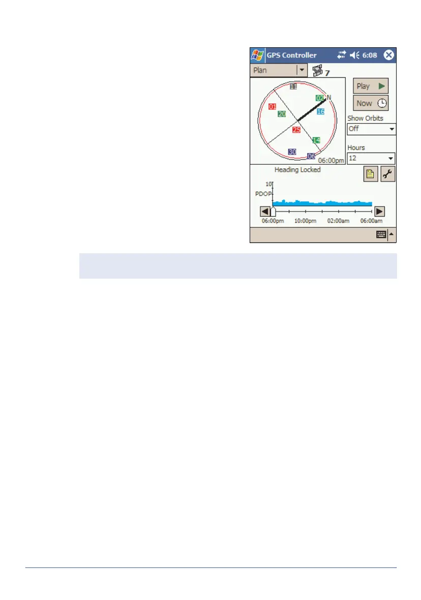
To maximize productivity, plan GPS
data collection around the times of
the day when satellite geometry is
best. The GPS Controller software
includes a Plan section with an
animated skyplot and DOP (satellite
geometry) graph for your position for
the next 12 hours.
In the Plan section, you can check the
planning skyplot as you play a
session, then use the timeline to
zoom in on times when geometry is
poor. As you adjust GPS settings, the
Plan section is updated, so you can
see the effect of different quality
control settings.
Using WAAS/EGNOS corrections
The GeoExplorer series handheld has an integrated receiver that uses
WAAS (Wide Area Augmentation System) or EGNOS (European
Geostationary Navigation Overlay System) correction messages to improve
GPS accuracy. The receiver tracks WAAS satellites between 30° West and
180° West, and tracks EGNOS satellites between 30° West and 90° East.
Note — If TerraSync or the GPScorrect extension for ArcPad is installed, use
the planning feature in that application instead of in GPS Controller.